Aim
Aim of this course is to provide you with an overview on geographic processes of urbanization, the related demographic and structural changes of cities, and data analyses methods using remote sensing data for applications in urban geography.
Content
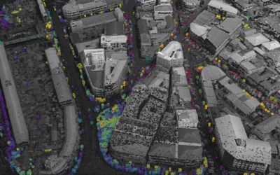
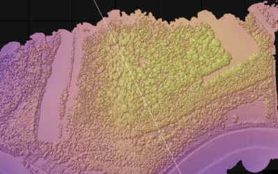
Humankind is within its largest migration ever: from rural areas into cities. The drivers of this global process of urbanization from demographic to economic and the related structural changes cities are facing will be discussed in this course. Remote sensing is one crucial data source in this dynamic transformation and its products are highly relevant for urban planning, as well as environmental management. Within this course different approaches and techniques are covered focusing on deriving relevant information about urbanized areas on different levels of detail. Uni-temporal-, multi-temporal-, and time series based image classification, segmentation, the analyses of point patterns, GIS analyses to assess spatial context and dependencies, as well as analyses in the 3D domain will be addressed in this course. This will be done providing and discussing example applications from different regions globally (e.g. urban sprawl analysis of megacities, the development of new dimensions of urban landscapes such as mega-regions, the rearrangement of business districts within the urban landscape, etc.). You will learn what capabilities Earth observation data, methods and products have for urban research and applications and how to design remote sensing based urban analysis, how to avoid caveats, troubleshoot errors and interpret the results.
General Course News and Updates
Internship Presentation: Application of Geospatial Science in Reinsurance
On Tuesday, May 07, at 12:00 Ronja Seitz will present her internship presentation on "Application of Geospatial Science in Reinsurance " in seminar room 3, John-Skilton-Str. 4a. From the abstract: I used the opportunity of my mandatory internship to enter an entirely...
Internship Report on Tuesday, April 30 at 14:00
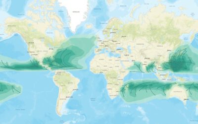
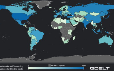
On Tuesday, April 30 Konstantin Müller will present his internship " GDELT News Analysis of the Noto Earthquake via ERNIE" at 14:00 in 01.B.03, John-Skilton-Str. 4a. : From the abstract: The analysis of socioeconomic data has gained increasing importance. The exchange...
Internship Report on Tuesday, April 23 at 12:00
On Tuesday, April 23rd Elly Schmid will present her internship at 12:00 in seminar room 3, John-Skilton-Str. 4a. : From the abstract: The internship was carried out as part of the HEATS-(Urban heat) Project of the Georisks team at the Earth Observation Center,...
EAGLE MSc. graduation
We are very happy to celebrate again the graduation of some of our EAGLE M.Sc. students. The candidates already handed in their M.Sc. thesis a while ago but just recently we had our EAGLE graduation party and enjoyed to celebrate this important milestone with all...
Master Thesis Defense: Unmasking the Shadow Economy in Ghana: Mapping The Distribution of Umbrella Covered Informal Vendors In Kumasi
On Tuesday, April 30, at 13:00 Prince Lartey Lawson will present his master thesis on " Unmasking the Shadow Economy in Ghana: Mapping The Distribution of Umbrella Covered Informal Vendors In Kumasi " in 01.B.03 Meeting Room 1st Floor, John-Skilton-Str. 4a. From the...
Master Thesis Defense: “Flood susceptibility mapping using remote sensing and geospatial data in West Africa “
On Tuesday, April 30, at 12:00 Wilmer Fabián Montién Tique will present his master thesis on " Flood susceptibility mapping using remote sensing and geospatial data in West Africa " in 01.B.03 Meeting Room 1st Floor, John-Skilton-Str. 4a. Abstract: Floods in West...

EAGLE workshop on Earth Observation application
Our first EAGLE workshop on Earth Observation applications covered various topics. After a heartily welcome by Tobias Ullmann did more than 50 participants listen to the following talks: Ása Aðalsteinsdóttir: “SAR Monitoring in Iceland” Katrin Wernicke:...

DGPF award for our EAGLE MSc Luisa Wagner
We are very happy to congratulate our former EAGLE student Luisa Wagner for the 2nd prize of the Karl‐Kraus‐Nachwuchsförderpreis 2024. Luisa received this award for her M.Sc. thesis which she handed in early last year on "Analysis of ice shelf front dynamics in Pine...

Master Thesis Defense: “Modelling the Spatio-Temporal Suitability of Urban Environments for Aedes Aegypti Mosquitoes based on their Bio-Ecological Characteristics in Rio de Janeiro “
On Friday, March 22, at 12:00 Rutendo Mukaratirwa will present her master thesis on " Modelling the Spatio-Temporal Suitability of Urban Environments for Aedes Aegypti Mosquitoes based on their Bio-Ecological Characteristics in Rio de Janeiro " in seminar room 3,...
Master Thesis Defense: “Development of Caribbean Seagrass Ecosystem Accounts fusing Earth Observation with Biophysical Modeling of Coastal Carbon” on Tuesday, March 19, 2024
On Tuesday, March 18, at 15:00 Andrea Cárdenas Reyes will present her master thesis on "Development of Caribbean Seagrass Ecosystem Accounts fusing Earth Observation with Biophysical Modeling of Coastal Carbon" in seminar room 3, John-Skilton-Str. 4a. ...