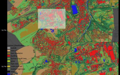
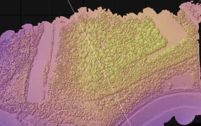
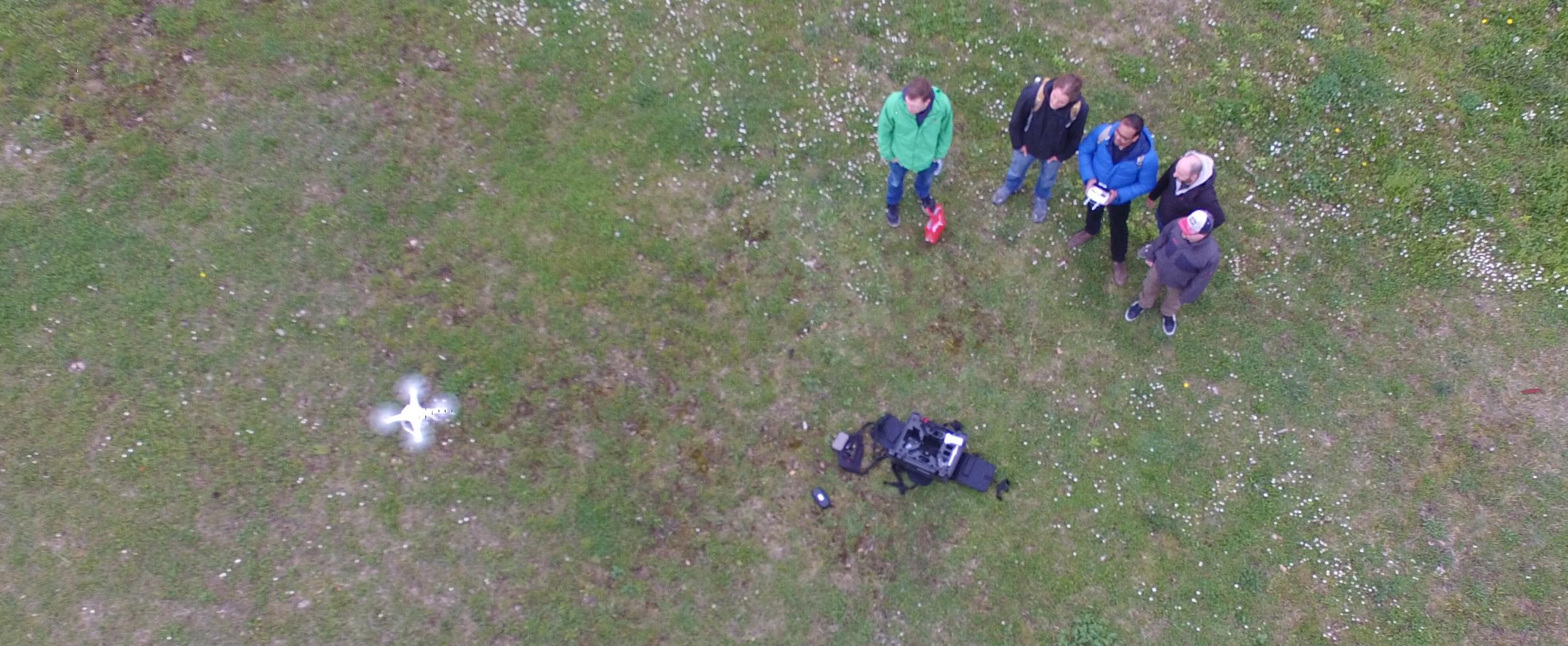
 The course on UAV application for Remote Sensing started successfully. The weather was good enough to do some first flights. In the next weeks and months more flights will be undertaken and data collected for different fields sites in order to gain more information concerning their ecology, geomorphology, archeology or forestry. Several software solutions and fields of applications will be explored such as deriving 10cm Digital Elevation Models. Especially the application of UAV data for remote sensing application will be addressed and the students will conduct a project to outline the potential and limits of such aerial imagery for remote sensing tasks.
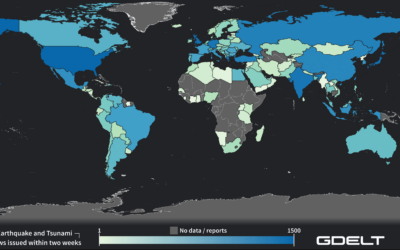
Internship Presentation: Application of Geospatial Science in Reinsurance
On Tuesday, May 07, at 12:00 Ronja Seitz will present her internship presentation on "Application of Geospatial Science in Reinsurance " in seminar room 3, John-Skilton-Str. 4a. From the abstract: I used the opportunity of my mandatory internship to enter an entirely...