Actual evapotranspiration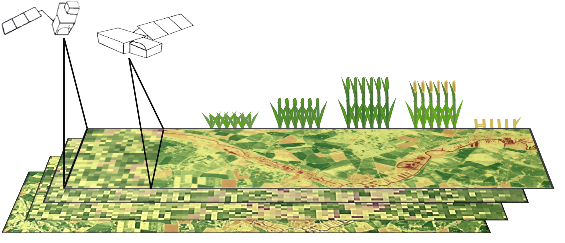 (ETact) is an essential component of the water balance and its determination for large areas is difficult on regional scale and can be explored within an innovation laboratory. The use of remote sensing data to determine ETact is particularly suitable to provide area based indicators for the evaluation of the efficiency and productivity of irrigation systems. Seasonal analysis of ETact is hampered by either spatial (MODIS) or temporal (Landsat) resolution. In order to provide a high-resolution (temporal and spatial) and dense remote sensing dataset Landsat and MODIS data will be fussed using the ESTARFM algorithm.

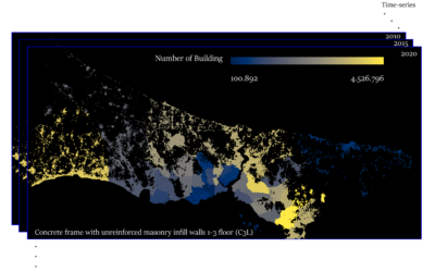
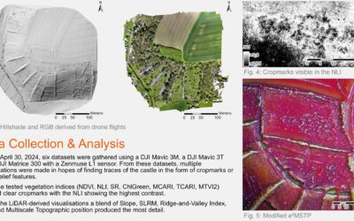
Blender GIS introduction
Within out EAGLE Earth Observation M.Sc. we also cover software applications which might not be used on a regular basis within our field of research but are sometimes highly useful to display our spatial data in a visually appealing way - and also potentially provides...