
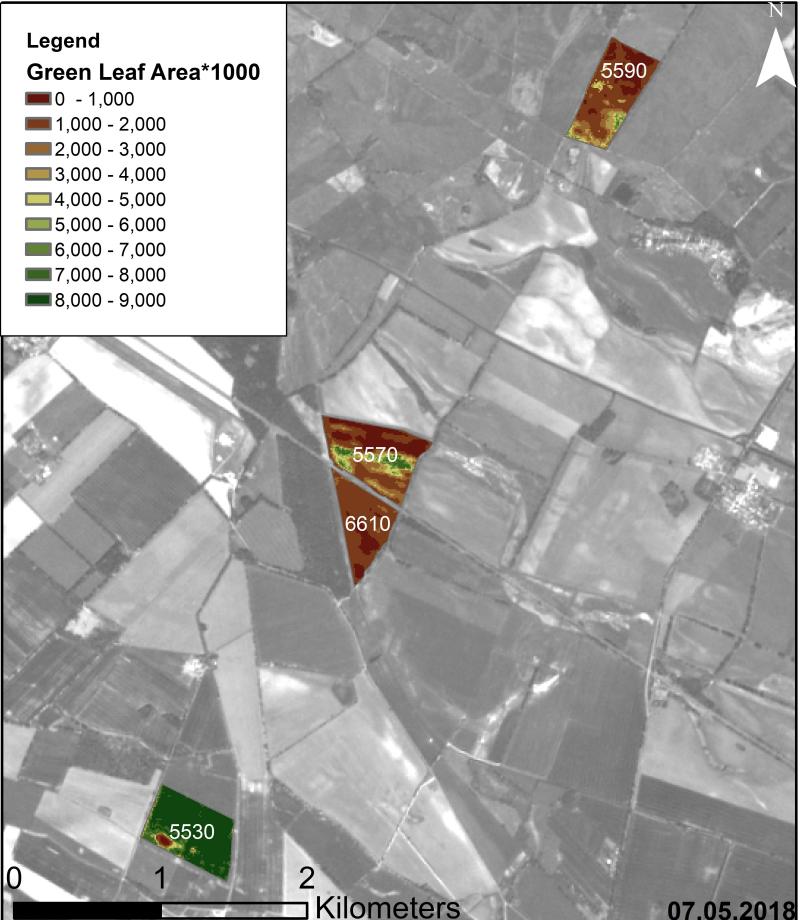
Anna Orthofer will present her M.Sc. thesis on Friday 7th of February at 10 am in room 1.009 OKW 86. Her M.Sc. was about “Deriving Leaf Area Index and mowing dates for grasslands based on the radiative transfer model SLC and Sentinel 2 data.” More details from the abstract: Grasslands account for more than one third of the world’s terrestrial surface and are therefore one of the most extensive ecosystems. With the food production heavily relying on grasslands as a source for high quality animal fodder for the meat and dairy industry, the pressure on these ecosystems is rising, especially in times of population growth and climate change. In order to meet the food demand while simultaneously ensuring the preservation of grasslands, the need for monitoring and management tools is growing. Leaves make up the majority of a plant’s biomass and play a vital role in the plants metabolism. Thus, the monitoring of leave area is a meaningful approach to observe not only the distribution of vegetation but also their health and biomass. Despite the common use of vegetation indices for the derivation of leaf area, radiative transfer models provide advantages due to their consideration of physical laws regarding radiation transfer within the canopy. This study aims to find a meaningful parameterisation for the soil leaf canopy radiative transfer model (SLC) for the retrieval of biophysical parameters such as the leaf area for the highly heterogeneous canopy of grasslands. In addition, mowing dates are detected on the basis of the SLC derived parameters to monitor management practices. A successive approach to find the best fitting parameterisation for the SLC was carried out, resulting in model outputs with an overall average RMSE of 1.43. Validating the retrieved leaf area with in-situ data showed a high correlation of r² = 0.97, therefore demonstrating that the approach is meaningful. Proceeding this validation, vegetation indices were calculated and correlated to the field data as well. With r² = 0.73 (NDVI) and r² = 0.72 (ENDVI) the results succumb to the simulated leaf area. The algorithm trained to detect mowing events on the basis of leaf area and vegetation indices time series also provided meaningful results when compared to field data. The derivation of leaf area and mowing events for large areas as well as long periods of time while being labour and cost effective based on Sentinel-2A and B data delivered satisfying results, therefore providing a meaningful tool in the monitoring and management of grasslands.


