
Henrik Fisser will present his M.Sc. thesis on Thursday 17th of June at 9am about “Sentinel-2-based moving truck detection for spatiotemporal road cargo emission and density approximation”.
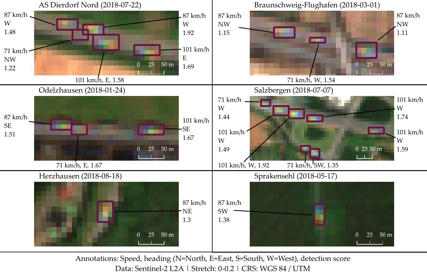
More details from his abstract: “In many countries freight is mainly transported on roads using cargo trucks. This produces gaseous and particulate emissions that can be hazardous to people and the environment NOx, heavy metals, particulate matter, carbon monoxide). 86 % of the exceeded NO2 limits in the European Union were recorded at traffic stations, in 2019. Many countries operate traffic count stations and air quality measurement stations. While providing temporally continuous measurements, these stations are spatially discontinuous, and exist at most sparsely in some areas of the world. In this work, a satellite remote sensing method for detecting large moving vehicles on roads, mainly trucks, is presented. It exploits a spectral band temporal sensing offset of the Sentinel-2 Multispectral Instrument, causing spatially and spectrally distorted signatures of moving objects. The method combines a random forest classifier trained on visual-near-infrared spectra from 2500 labeled target objects in ten globally distributed areas, with a spatial object extraction method. Object detection performance was evaluated using 350 labeled target bounding boxes in ten countries. The used classifier has an overall accuracy of 84 %, the mean F1 score for the final target object detection is 0.74. Validated at 26 traffic count stations in Germany for 390 acquisition dates in 2018, the detection method correlates well with trucks counted by the stations (Pearson r-value: 0.82). Yearly mean Sentinel-2 truck detections and mean truck counts at weigh stations in Kenya strongly correlate (Pearson r-value: 0.99). At NO2 measurement stations in traffic settings in Germany, moderate correlations between Sentinel-2 truck counts and measured NO2 were observed (Pearson r-values up to 0.58), as well as between Sentinel-2 trucks and particulate matter smaller than 2.5 µm (PM2.5) in Kenya (Pearson r-values: 0.42 and 0.97). The comparison of Sentinel-2 truck counts and Sentinel-5P total NO2 columns in an area in northern Germany shows ambiguous results with a similar amount of strong negative and positive correlations (Pearson r-values > 0.5). Beyond the presented work, spatially and temporally extended comparisons of truck abundance and measured air pollutants could foster an understanding of the road cargo contribution to air pollutant emissions. Moving truck detection with freely available and regularly acquired Sentinel-2 data is new. Provided further global validation, it may support a range of research fields and applications, from modelling traffic and emissions to approximating economic performance. The Sentinel-2 moving truck detection method could support research on environmental and economic implications of road cargo, fill spatial gaps in countries with close-meshed ground data availability, and create previously nonexistent information in countries where data on road cargo emissions and density is sparse.”
supervisors: Martin Wegmann and Frank Baier (DLR)


