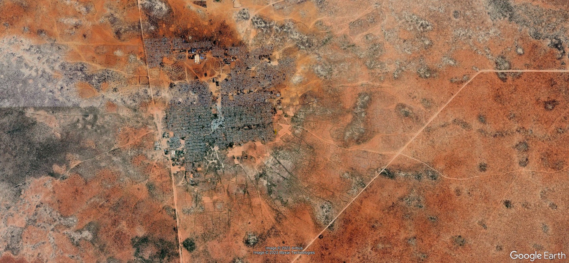
On Tuesday, July 18 at 10 a.m. Katrin Wernicke will present her MSc Thesis “Deep Learning for Refugee Camps – Mapping Settlement Extents with Sentinel-2 Imagery and Semantic Segmentation”
From the abstract:
The number of people forced to flee their homes has more than doubled in the last decade, with over 103 million displaced people by mid-2022. Many seek shelter in refugee camps and informal settlements, which were originally built as temporary facilities. Remote sensing and Deep Learning serve as independent tools for monitoring camps in addition to localised in-situ data. However, research shows an underrepresentation of refugee camps in satellite-based settlement products. This work assessed the applicability of six Deep Learning (DL) models for mapping refugee settlement extents worldwide using semantic segmentation of Sentinel-2 satellite imagery. Two DL architectures, U-Net and FPN, were trained with the encoders EfficientNet-B0, MobileNet-V2, and ResNet-18, and their results were assessed in a comparative analysis. Furthermore, the model accuracies across space and among different morphological structures were evaluated. The results showed that all models faced significant challenges in accurately mapping the settlement extents, although to different degrees. However, some models were successful in localising the camps but overestimated the extents. The analysis revealed that the accuracies varied among camps, and regional clusters of similar accuracies were observed. It is discussed that refugee camps are heterogeneous and complex settlement types which are difficult to delineate in space based on their spatial appearance alone and inconsistent morphological structures. The work highlights the complexity of mapping refugee settlements in a large-scale approach and emphasizes the consideration of morphological differences among camps in image analysis tasks. The findings of this work serve as a foundation for future research on mapping refugee settlement extents with remote sensing for humanitarian aid.
1st supervisor: Prof. Dr. Hannes Taubenböck
2nd supervisor: Jakob Schwalb-Willmann

