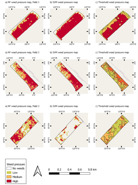
On March 8th at 10:30 Nestor will present his M.Sc. thesis “Pre-crop emergence weed mapping using high satellite imagery”. From the abstract: “During the last decades, the growth of the world population has been increasing and weather fluctuations around the world have put huge pressure on agricultural food products for quality and sustainable food production. As result, increased competition for land and water resources are likely to increase vulnerability to food insecurity. This could lead to their overexploitation and unsustainable use causing environmental degradation. Weeds are one of the most common pests in crops and represent important losses in crops yields. The most common method of weed control is to spray the herbicide evenly over the entire field. However, this method is linked to the massive consumption of herbicides which causes wastage of valuable compounds, environmental pollution, and agrochemical residues on food products. Therefore, the objective of this study was to generate weed pressure maps showing the distribution of the weeds in the pre-emergence stage of the crop. To achieve this, Planet-Scope and Sentinel-2 data is utilized to classify weed areas in the year 2020. Two methods are used to classify the satellite images, a thresholding method which is a pixel-based classification, and a machine learning method an object-based classification. The outcomes of this study have demonstrated that the considered methodology was able to detect and delimit weed areas successfully. The weed pressure maps obtained in this study show a potential to use as input to smart sprayers, to distinguish target weeds areas from non-target areas and precisely spray on the desired location. This could help farmers to reduce costs of crop damage and herbicide wastage, as well as potentially reduce environmental pollution.”
supervisors: Michael Thiel and Julian Blau (Xarvio Digital Farming)


