Our students won the DLR Copernicus challenge 2021!

Great to see again our EAGLE students winning the DLR Copernicus challenge. Last year Henrik Fisser won with his truck detection approach, this year our EAGLE students Sofia Garcia, Annika Ludwig, Nils Karges, Andreas Bury and Antonio Castaneda won the DLR Copernicus challenge with their UrbanSens idea of mapping urban heat islands with multiple sensors in combination with Earth Observation technologies.

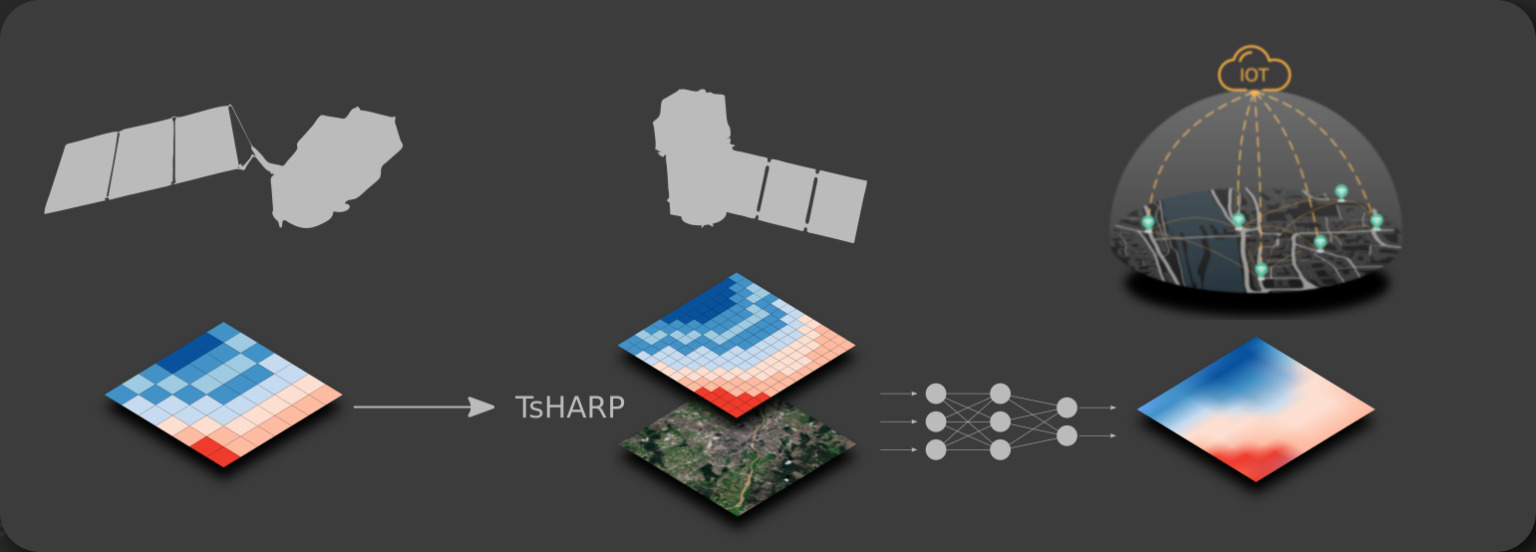
Their UrbanSens project developed static and mobile “low-cost” IOT (Internet Of Things) sensors for data acquisition on environmental parameters. The main aim is to build up sensor networks in urban areas  in order to retrieve reliable in-situ measurements and ensure the near-real-time data communication. In a next step this data is linked to Earth Observation Data to get a deeper insights in urban areas with street-level information of environmental parameters like temperature for decision-makers and citizens. read more at www.urbansens.org

read more news:

EAGLE summer dialogue

EAGLE summer dialogue

Our annual EAGLE summer dialogue was a great success again even though the weather was quite challenging. The EAGLEs organized a fantastic event with fun activities, great images reviving the last months and years and of course a BBQ, drinks and an outstanding...

new publication by our EAGLE student Clara Vydra

new publication by our EAGLE student Clara Vydra

Our EAGLE student Clara just published an article about snow cover variability in Central Asia - great to see our young EAGLE MSc students being on a good track for their scientific career. from the abstract: "Climate change is affecting the snow cover conditions on a...

UAS team – meme

UAS team – meme

The UAS (UAV or drone) team was quite busy the last months to collect data in Europe, Africa or Arctic and the group spend plenty of hours traveling and collecting Lidar, multispectral, thermal or hyperspectral data in various ecosystems. Of course in many cases faced...

scientific graphics course

scientific graphics course

Beside the various remote sensing courses such as radar, cloud computing, terrain analysis, urban analysis etc. we do also offer courses on softskills such as scientific writing, presentations as well scientific graphics and maps. Within our scientific graphics course...

EAGLE students introduce locust spatio-temporal modeling

EAGLE students introduce locust spatio-temporal modeling

Our EAGLE students Leonie, Sonja and Clara presented methods to model the spatial and temporal distribution of locust in France using statistical modelling approaches within R and the flexSDM package. The elaborated for two hours how the complex data preparation,...