Our EAGLE students preparing our UAVs with thermal, multispectral and Lidar sensors for the upcoming field work season. Also wearing our new field work jackets so that we all are easily recognizable as Earth Observation researchers.
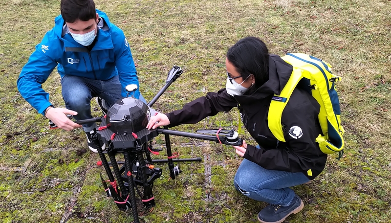



Our EAGLE students preparing our UAVs with thermal, multispectral and Lidar sensors for the upcoming field work season. Also wearing our new field work jackets so that we all are easily recognizable as Earth Observation researchers.

A new EAGLE generation means new faces, new ideas, and the start of another journey in Earth Observation. And what better way to kick things off than with a relaxed evening at the pub? Our first social event brought together the new students, older EAGLE generations,...

The newest group of EAGLE students arrived in Würzburg! They come from different countries, with different backgrounds and different skills, and that’s exactly what makes this program special. Remote sensing is a big field, and it gets better when people look at it...

Jolien spent her internship in Kruger National Park in South Africa, working together with SANParks. She was part of an ongoing DFG project here at EORC that looks at how fire and drought shape savanna ecosystems. The project is led by Mirjana Bevanda and Tobias...

Most remote sensing work happens in the daylight, at a desk or in a field with a drone. Jolien Grafe, one of our EAGLE M.Sc. students, spent a good part of her internship doing the opposite: sitting on a hill at dusk, listening for a beeping signal from a very small,...
![[Spotlight] Lecturer Spotlight: Julian Faeth](https://eagle-science.org/wp-content/uploads/2026/10/Julian_Faeth_EORC_EAGLE_2026-400x250.jpg)
Dr. Julian Fäth is a postdoctoral researcher at our EORC. His teaching combines remote sensing, forest ecology and geospatial data science with a strong focus on operational applications and climate adaptation. Since 2018, Julian has been actively involved in...

On September 22, 2026, Agnes Zwick will present her Master Thesis on " New Housing Development Areas: Assessing Structural Types and Environmental Effect" at 10:00 at the seminar room 3 in John-Skilton-Str. 4a. From the abstract: Germany faces a persistent tension...

On September 22, 2026, Henning Riecken will present his internship results on " Internship at the German Remote Sensing Data Center (DFD) of the German Aerospace Center (DLR)" at 12:00 at the seminar room 3 in John-Skilton-Str. 4a. From the abstract: Through the...

On August 25, 2026, Lutz Kleemann will present his internship results on " Verifiable Nature Units" at 12:00 at the seminar room 3 in John-Skilton-Str. 4a. From the abstract: Biodiversity credits and conservation work increasingly depend on measurable outcomes. During...

On August 11, 2026, Espérance Kandjale will present her Innolab results on " Post-processing and Quality Assessment of Mapathon-Derived Mining Data for Cobalt Belt Mapping " at 12:00 in seminar room 3, John-Skilton-Str. 4a. From the abstract: During my internship, I...