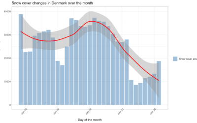
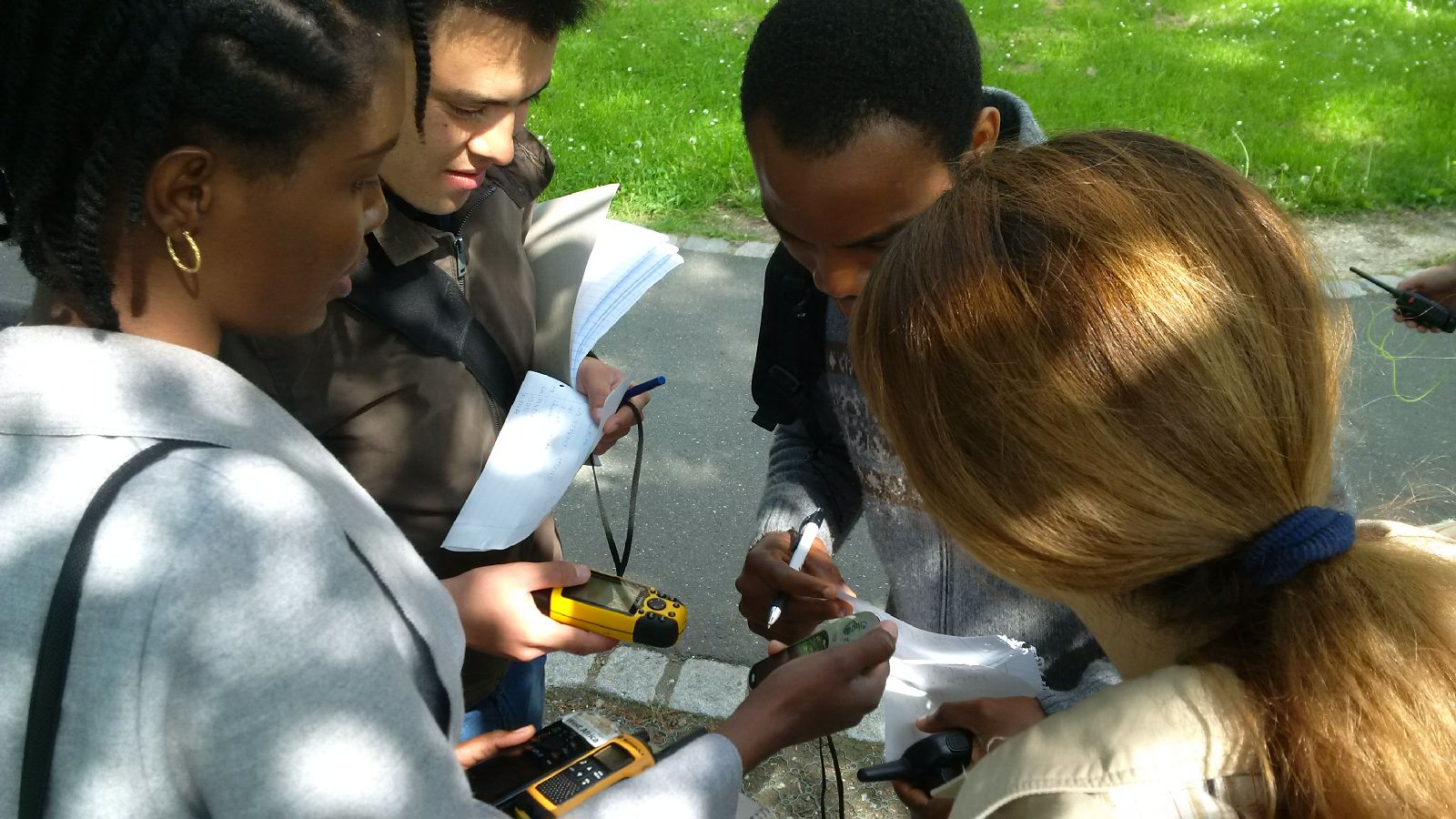
 The course “from field work to spatial data” by Tobias Ullmann and Martin Wegmann is covering the whole range of field campaign planning and especially training all necessary methods such as GPS handling, coordinate systems, setting waypoints or finding locations. In the next weeks the EAGLE students will collect field data, link it to attribute tables, import it into a GIS and create a land cover classification. The final project will be an actual field campaign in the Steigerwald area which they have to design, plan, coordinate and analyze it.
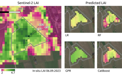
Master Thesis Presentation: Modelling LAI of Alpine Grassland
On Tuesday, June 04 , Caroline Göhner will defend her master thesis " Modelling LAI of Alpine Grassland" at 12:00 in seminar room 3, John-Skilton-Str. 4a. From the abstract: Alpine grasslands are crucial ecosystem providers and one of the most threatened terrestrial...