Internship Presentation: Application of Geospatial Science in Reinsurance

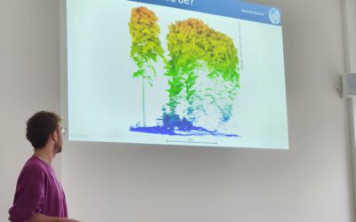
On Tuesday, May 07, at 12:00 Ronja Seitz will present her internship presentation on “Application of Geospatial Science in Reinsurance ” in seminar room 3, John-Skilton-Str. 4a.
From the abstract: I used the opportunity of my mandatory internship to enter an entirely different field in comparison to my previous work experiences, the reinsurance sector. I stayed for 6 month full-time at the biggest reinsurer worldwide – the MunichRe, at their headquarters in Munich. The focus of my department laid on providing internal services related to spatial data including internal tools, data analysis or management of geodata or geosoftware. I supported my team in data processing, data assessment and data analysis and creating and updating internal tools. Throughout my six months at MunichRe I made a lot of professional and personal progress, e.g. gaining proficiency in Python or increasing openness and communication skills.
Supervisor: Dr. Mirjana Bevanda Hosting Institution: Munich Re/Münchner Rück

read more news:

Cooperation with Namib desert Research Institute Gobabeb

Cooperation with Namib desert Research Institute Gobabeb

The Namib desert research station Gobabeb (www.gobabeb.org) is involved in diverse research projects and is hosting various students and researchers from a wide range of backgrounds and nationalities. They are also already involved in remote sensing and very...

EAGLE summer dialogue

EAGLE summer dialogue

Our annual EAGLE summer dialogue was a great success again even though the weather was quite challenging. The EAGLEs organized a fantastic event with fun activities, great images reviving the last months and years and of course a BBQ, drinks and an outstanding...

new publication by our EAGLE student Clara Vydra

new publication by our EAGLE student Clara Vydra

Our EAGLE student Clara just published an article about snow cover variability in Central Asia - great to see our young EAGLE MSc students being on a good track for their scientific career. from the abstract: "Climate change is affecting the snow cover conditions on a...

UAS team – meme

UAS team – meme

The UAS (UAV or drone) team was quite busy the last months to collect data in Europe, Africa or Arctic and the group spend plenty of hours traveling and collecting Lidar, multispectral, thermal or hyperspectral data in various ecosystems. Of course in many cases faced...

scientific graphics course

scientific graphics course

Beside the various remote sensing courses such as radar, cloud computing, terrain analysis, urban analysis etc. we do also offer courses on softskills such as scientific writing, presentations as well scientific graphics and maps. Within our scientific graphics course...

EAGLE students introduce locust spatio-temporal modeling

EAGLE students introduce locust spatio-temporal modeling

Our EAGLE students Leonie, Sonja and Clara presented methods to model the spatial and temporal distribution of locust in France using statistical modelling approaches within R and the flexSDM package. The elaborated for two hours how the complex data preparation,...