Actual evapotranspiration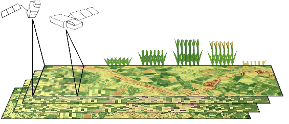 (ETact) is an essential component of the water balance and its determination for large areas is difficult on regional scale and can be explored within an innovation laboratory. The use of remote sensing data to determine ETact is particularly suitable to provide area based indicators for the evaluation of the efficiency and productivity of irrigation systems. Seasonal analysis of ETact is hampered by either spatial (MODIS) or temporal (Landsat) resolution. In order to provide a high-resolution (temporal and spatial) and dense remote sensing dataset Landsat and MODIS data will be fussed using the ESTARFM algorithm.

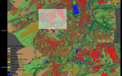
Master Thesis Presentation: Analysis of Urban Heat Development in Dresden, Germany using Landsat Data from the Past Decade
On Tuesday, May 28, Ina Schulz will defend her master thesis " Analysis of urban heat development in Dresden, Germany using Landsat data from the past decade" at 12:00 in seminar room 3, John-Skilton-Str. 4a. From the abstract: As the number of urban residents is...