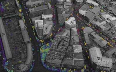
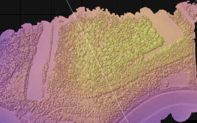
The Whitebox geospatial software offers a wide range of functionality which are partly also not available in other packages, such as hydrological analysis or Lidar processing. Our earth observation EAGLE students are learning diverse geospatial software packages in order to empower them to pick the right tool for the right task.
Today the whitebox software plus the python interface is introduced and nicely fits into the overarching framework of our EAGLE courses with Python programming or Lidar analysis. It provides additional analytical back-end functionality for GIS systems like QGIS. Due to the fact that we trained QGIS for various spatial tasks in the larger months, the use of whitebox functions with QGIS is easy and straight-forward.
Today the whitebox software plus the python interface is introduced and nicely fits into the overarching framework of our EAGLE courses with Python programming or Lidar analysis. It provides additional analytical back-end functionality for GIS systems like QGIS. Due to the fact that we trained QGIS for various spatial tasks in the larger months, the use of whitebox functions with QGIS is easy and straight-forward.