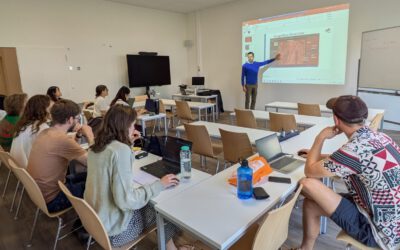
On Tuesday, April 30, at 13:00 Prince Lartey Lawson will present his master thesis on ” Unmasking the Shadow Economy in Ghana: Mapping The Distribution of Umbrella Covered Informal Vendors In Kumasi ” in 01.B.03 Meeting Room 1st Floor, John-Skilton-Str. 4a.
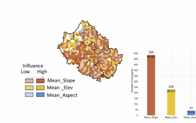
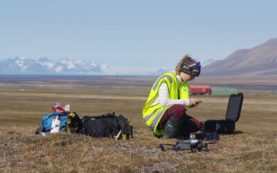
From the abstract: Informal trade in sub–Saharan Africa is still prevalent and for such businesses to transition towards sustainability, reliable information reflecting their extent is crucial. In this study, data from Unmanned Aerial System campaigns executed from 2017 to 2023 were repurposed for the detection and quantification of informal trade activities canopied under umbrellas in Kumasi, Ghana. Umbrella Covered Informal Vendors (UCIV) were deciphered under the requirements of the Ghanaian Registrar General’s Department as informal entities in this study. However, due to No-Flight Zones and other restrictions making UAS data for the entirety of Kumasi unattainable, a Random Forest regression model was utilized to predict the total count of UCIV in Kumasi. Additionally, the efficiency of 2D and 3D data types in instance segmentation of UCIV were compared.
1st supervisor : Dr. Michael Thiel 2nd supervisor: Jakob Schwalb-Willmann