Julia Sauerbrey will defend her M.Sc. “Integration of SAR and Optical Satellite Imagery: Time-Series Analysis of Sentinel-1 and Sentinel-2 Imagery for Detection of Active Morphodynamics: A Case Study in the Atacama Desert, Chile” on Thursday 9th of May at 10am in room 0.004 (OKW 86).
from the abstract: The Copernicus Mission of the European Space Agency (ESA) provides freely available data from several satellite missions. The Sentinel-1 misson operates with a C-Band Synthetic Aperture Radar (SAR) system suitable for interferometric applications (InSAR) at a high spatial resolution of about fifteen meters in the Interferometric Wide Swath mode. The swath width of 250km is designed to overcome existing limitations in data coverage.
The optical Sentinel-2 satellite mission carries a multi-spectral push-broom sensor instrument (MSI), measuring 13 spectral bands in the Visible, Near Infra-red and Short Wave Infra-red domain of the electromagnetic spectrum. With a width of 290km of the field of view, Sentinel-2 acquires large amounts of data and continues the legacy of the Landsat mission.
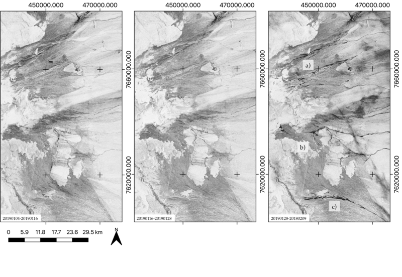
With advantages from both sensor systems, S-1 and S-2 can be used complementary in order to quantify and monitor surface alterations related to active morphodynamics in a completely new and vast extent. The focus was set on investigating changes in interferometric coherence using short temporal baselines in comparison with optical imagery.
The Coherence Change Detection technique revealed geomorphologic activity at different scales. Those events caused de-correlation of the SAR signals, causing a drop in coherence. Even though such activity was not recognisable in the S-1 intensity data, nor directly in the S-2 optical data and its derivations, distinction between different kinds of activity was enabled indirectly by the S-2 data.
This study exhibits the potential of integrated S-1 and S-2 time series analysis for identification of different types of surface alterations including fluvial channel activity, aeolian and vegetation-related activity, as well as anthropogenic activity. The investigation period of this study ranged between November 2015 to May 2018.


