Aim
In this seminar, we cover most aspects of remote sensing based assessment of Land Surface Dynamics. Topics such as snow cover dynamics, water body dynamics, forest cover and further vegetation dynamics, urbanization dynamics, coastal dynamics, or dynamics of geophysical parameters such as land surface temperature or selected indices will be addressed. In this contexts we look at opportunities arising from optical-, multi-spectral- and radar sensors, as well as thermal imagery. Data availability and access, as well as typical software tools for the handling of multispectral data or time-series analyses will be addressed as well. The course will consist of a theoretical part and a practical part, where the theory consists of a seminar (written seminar and presentation on a topic to be chosen from a list of available topics), and where the practical will consist of data processing examples.
Content
Topics cover most aspects of remote sensing based assessment of Land Surface Dynamics. Topics such as snow cover dynamics, water body dynamics, forest cover and further vegetation dynamics, urbanization dynamics, coastal dynamics, or dynamics of geophysical parameters such as land surface temperature or selected indices will be addressed. We adress questions such as climate change induced shifts of snow or rainy seasons, look at patterns of forest loss and degradation over time, analyze urbanization patterns and impacts of these processes on the natural environment, and assess changes in coastal morphology. Sensors in focus will be the ones allowing for long time series analyses, such as AVHRR, MODIS, ENVISAT, Landsat, TerraSAR-X, and the Sentinel Satellites.
Coding
Software
Techniques
Content
General Course News and Updates

applications for 2016
The application deadline for the winter term 2016 was last Friday and we are now working through the numerous application. We are happy to have received a very high number of applications from all around the world and will get back to the applicants as soon as...

application opened for winter term 2016
The application is opened to apply for the EAGLE M.Sc. program starting this winter term 2016. The application deadline is July 15th 2016 (23:59, CEST). Please feel free to contact us beforehand to discuss open questions but please check our FAQ first. EAGLE is...
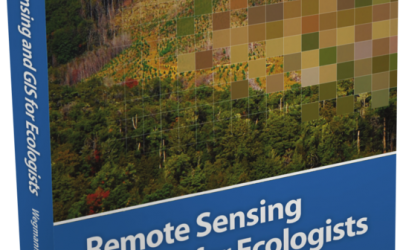
book: Remote Sensing and GIS for Ecologists
The book "remote sensing and GIS for ecologists - using Open Source software" edited by the EAGLE lecturer Martin Wegmann is a book about how ecologists can integrate remote sensing and GIS in their daily work. It will allow ecologists to get started with the...
MSc opportunities: remote sensing in ecology and conservation
Biodiversity analysis and conservation decision relies on adequate and meaningful data that are available on a long-term and global basis. Such environmental information need adequate spatial and temporal resolution and remote sensing data does provide a wide range...
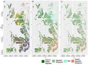
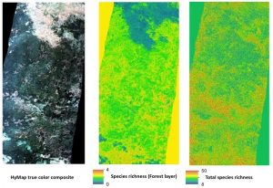
MSc handed in on impact of remote sensing for biodiversity monitoring
Anna Stephanie handed in her MSc thesis on “Impact of remote sensing characteristics for biodiversity monitoring”. Very impressive study on multi-scale, multi-model and multi-variable analysis of mangroves in Myanmar. She was supervised by Martin Wegmann. While...
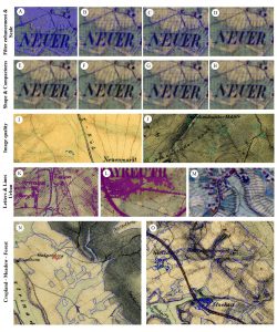
MSc handed in on object-oriented classification of historical maps for ecosystem services
Yrneh Ulloa handed in her MSc “Land change in the Main catchment with an Object Based approach using eCognition” within GCE which dealt with classifying landcover in historical maps (1810+) automatically using object oriented approaches. She was supervised by Martin...
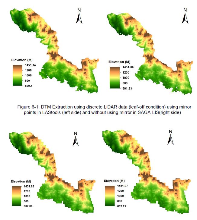
MSc: Analysis of Airborne LiDAR Data for Deriving Terrain and Surface Models
The M.Sc thesis by Raja Ram Aryal has been handed in (supervision of Dr. Hooman Latifi and Prof. Michael Hahn). The thesis focused on a comparative study on the variations of an adaptive TIN ground filtering algorithm to extract DTM from discrete LiDAR point cloud...
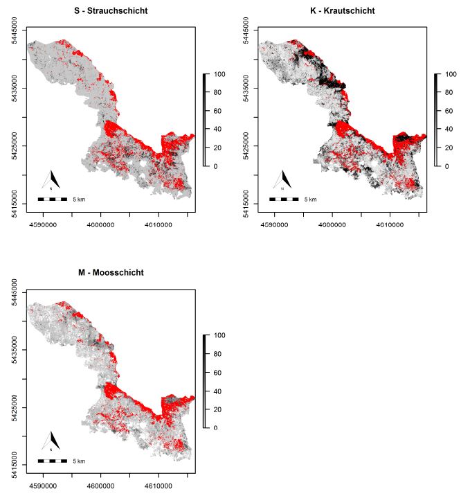
MSc: predicting forest understory canopy cover
The M.Sc thesis by Bastian Schumann focused on a LiDAR-based approach to combine structural metrics and forest habitat information for causal and predictive models of under-story canopy cover. The data base used consisted of a bi-temporal LiDAR dataset as well as two...
Explore species-environment interaction
Analyzing species-environment interaction is feasible using various data and method. An increasing technology is the tracking of animals and especially its linkage to remote sensing, as covered in AniMove.org. However, with this technology new challenges have to be...
MSc by Asja Bernd: “Mind the Gap: A Global Analysis of Grassland Fragmentation using MODIS Land Cover Data”
The MSc thesis by Asja Bernd titled “Mind the Gap: A Global Analysis of Grassland Fragmentation using MODIS Land Cover Data” is handed in. Very interesting results on global grassland fragmentation. Read the abstract:Around the world, grassland and savannah...