Aim
In this course we will learn the alternative image analysis paradigm of object-based image classification. Image objects are areas in images which consist of pixels from the same land-cover class (e.g. buildings, water surfaces, vegetation) and allow the application of additional image classification methods in comparison to pure pixel-based methods and the integration of multi-modal date (e.g. vector data).
Content
In the course we will use satellite images and high resolution aerial images in combination with vector data and analyze various image classification methods (nearest neighbor -> random forests -> deep learning) to extract relevant information from the images.
We will use the software “eCognition”.
The course will be held on 3 days in Würzburg plus an introductory lecture which is being held online.
Session 1: getting to know to image objects and eConition software, basic classification methods
Session 2: advanced classification (Machine Learning)
Session 3: Deep Learning
Coding
Software
Techniques
Content
General Course News and Updates
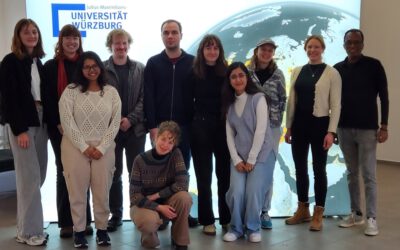
EAGLE Students Marlene Bauer and Anna Bischof to Participate in ISRSE 2025
We are very pleased to share that two of our students, Marlene Bauer and Anna Bischof, will be actively contributing to the International Symposium on Remote Sensing of Environment (ISRSE) 2025 in the UK next week. As part of their involvement with talks and posters,...
course on Theory and Practice of UAS Operation and Methods
Last week our staff members Antonio Gomez Castaneda and Luisa Pflumm did an UAS course within out EAGLE M.Sc. program. The primary objective of this course is to prepare students — from having no prior experience — to safely operate drones for scientific applications....
Mastering Scientific Presentations: How EAGLE MSc Students Elevate Their Soft Skills
In the world of science, research is only as powerful as its communication. At the EAGLE MSc program, we recognize that technical expertise alone isn’t enough—soft skills like scientific writing, visual storytelling, and presentation skills are just as crucial. That’s...
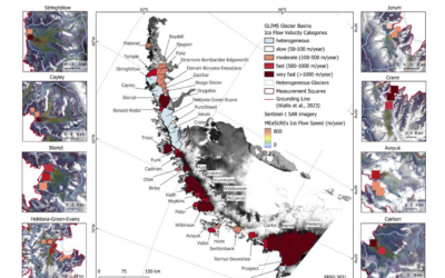
EAGLE Master Defense “High Performance Computing for Earth Observation Time Series Analysis: A Case Study on Glacier Dynamics on the Antarctic Peninsula”
On February 28, 2025, Sarah Leibrock will present her internship on "High Performance Computing for Earth Observation Time Series Analysis: A Case Study on Glacier Dynamics on the Antarctic Peninsula" at 11:00 in seminar room 3, John-Skilton-Str. 4a.High Performance...
EAGLE course by Dr. Celia Baumhoer on Polar and Glacier Earth Observation
Our EAGLE students had this week the opportunity to attend an intensive course led by Dr. Celia Baumhoer, an expert in Earth observation of polar and glacier ecosystems. The course, which covered both the Antarctic and Arctic regions, as well as glaciers in the Alps,...

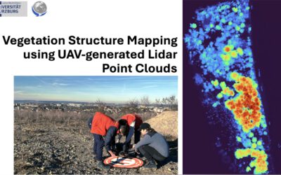
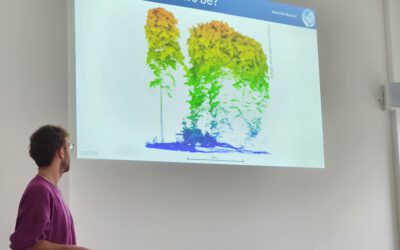
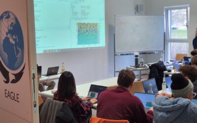
EAGLE Students Explore LiDAR Data with QGIS, Whitebox, and CloudCompare
At EAGLE, our students continuously expand their expertise in Earth observation by learning various data processing techniques. Today, they are diving into LiDAR data analysis, using QGIS, Whitebox, and CloudCompare to enhance their skills in handling different remote...

Exploring Whitebox Tools: EAGLE Students Dive into Geomorphology and Hydrology Applications in QGIS
In the world of Earth observation and geospatial analysis, staying ahead of the curve requires familiarity with the diverse environments and various powerful scientific software tools. At EAGLE, our students have the opportunity to also explore the vast potential of...
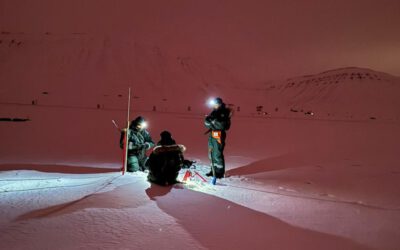
Exploring the Arctic: Eagle MSC Students Lena and Ronja Conducting UAS Research
The Arctic is one of the most extreme and fascinating environments on Earth, offering an unparalleled opportunity for scientific research. For Eagle MSC students Lena and Ronja, this unique landscape is not just a place of study—it's also an unforgettable adventure....
Integrating R and Whitebox Tools for Geospatial Analysis
Within the EAGLE M.Sc. program our Earth Observation students have managed to understand some important research approaches within just the first term of their studies. Integrating and working with several environments simultaneously is a critical tasks for their...
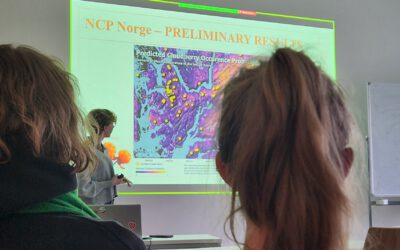
Mapping NCPs in Norway: An Internship Presentation by Sonja Maas
On January 28, 2025, Sonja Maas delivered an insightful presentation on her internship project titled "Mapping Ecosystem Services in Norway." Hosted by the University of Bergen, this internship focused on the critical role that nature plays in supporting human...