Aim
In this course we will learn the alternative image analysis paradigm of object-based image classification. Image objects are areas in images which consist of pixels from the same land-cover class (e.g. buildings, water surfaces, vegetation) and allow the application of additional image classification methods in comparison to pure pixel-based methods and the integration of multi-modal date (e.g. vector data).
Content
In the course we will use satellite images and high resolution aerial images in combination with vector data and analyze various image classification methods (nearest neighbor -> random forests -> deep learning) to extract relevant information from the images.
We will use the software “eCognition”.
The course will be held on 3 days in Würzburg plus an introductory lecture which is being held online.
Session 1: getting to know to image objects and eConition software, basic classification methods
Session 2: advanced classification (Machine Learning)
Session 3: Deep Learning
Coding
Software
Techniques
Content
General Course News and Updates
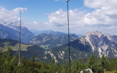
Internship Presentation: Small-scale 3D model generation by photogrammetry of alpine vegetation in Berchtesgaden National Park
On Tuesday, August 20, 2024 at 10:00 a.m. Daniel Gruschwitz will present his internship "Small-scale 3D model generation by photogrammetry of alpine vegetation in Berchtesgaden National Park" in seminar room 3, John-Skilton-Str. 4a. From the abstract: Nature in...

EAGLE summer dialogue
Our annual EAGLE summer dialogue was a great success again even though the weather was quite challenging. The EAGLEs organized a fantastic event with fun activities, great images reviving the last months and years and of course a BBQ, drinks and an outstanding...

new publication by our EAGLE student Clara Vydra
Our EAGLE student Clara just published an article about snow cover variability in Central Asia - great to see our young EAGLE MSc students being on a good track for their scientific career. from the abstract: "Climate change is affecting the snow cover conditions on a...

UAS team – meme
The UAS (UAV or drone) team was quite busy the last months to collect data in Europe, Africa or Arctic and the group spend plenty of hours traveling and collecting Lidar, multispectral, thermal or hyperspectral data in various ecosystems. Of course in many cases faced...

scientific graphics course
Beside the various remote sensing courses such as radar, cloud computing, terrain analysis, urban analysis etc. we do also offer courses on softskills such as scientific writing, presentations as well scientific graphics and maps. Within our scientific graphics course...

EAGLE students introduce locust spatio-temporal modeling
Our EAGLE students Leonie, Sonja and Clara presented methods to model the spatial and temporal distribution of locust in France using statistical modelling approaches within R and the flexSDM package. The elaborated for two hours how the complex data preparation,...

Internship Presentation: Discovering Hydrographic Parameters of HydroSHEDS and TanDEM-X Digital Elevation Model through Exploratory Data Analysis on July 09, 2024
On Tuesday, July 09, Subarno Shankar will present his internship " Discovering Hydrographic Parameters of HydroSHEDS and TanDEM-X Digital Elevation Model through Exploratory Data Analysis " at 12:00 in seminar room 3, John-Skilton-Str. 4a. From the abstract: Climate...

Master Thesis Presentation: Earth Observation for Wildlife Monitoring in cold and polar Regions – A Review and a Case Study about the Northern Bald Ibis on June 11, 2024
On Tuesday, June 11 , Helena Wehner will defend her master thesis " Earth Observation for Wildlife Monitoring in cold and polar Regions – A Review and a Case Study about the Northern Bald Ibis" at 13:00 in seminar room 3, John-Skilton-Str. 4a. From the abstract:...

Master Thesis Presentation: Analysis of Urban Heat Development in Dresden, Germany using Landsat Data from the Past Decade
On Tuesday, May 28, Ina Schulz will defend her master thesis " Analysis of urban heat development in Dresden, Germany using Landsat data from the past decade" at 12:00 in seminar room 3, John-Skilton-Str. 4a. From the abstract: As the number of urban residents is...

Master Thesis Presentation: Modelling LAI of Alpine Grassland on June 11, 2024
On Tuesday, June 11 , Caroline Göhner will defend her master thesis " Modelling LAI of Alpine Grassland" at 12:00 in seminar room 3, John-Skilton-Str. 4a. From the abstract: Alpine grasslands are crucial ecosystem providers and one of the most threatened terrestrial...