Aim
In this course we will learn the alternative image analysis paradigm of object-based image classification. Image objects are areas in images which consist of pixels from the same land-cover class (e.g. buildings, water surfaces, vegetation) and allow the application of additional image classification methods in comparison to pure pixel-based methods and the integration of multi-modal date (e.g. vector data).
Content
In the course we will use satellite images and high resolution aerial images in combination with vector data and analyze various image classification methods (nearest neighbor -> random forests -> deep learning) to extract relevant information from the images.
We will use the software “eCognition”.
The course will be held on 3 days in Würzburg plus an introductory lecture which is being held online.
Session 1: getting to know to image objects and eConition software, basic classification methods
Session 2: advanced classification (Machine Learning)
Session 3: Deep Learning
Coding
Software
Techniques
Content
General Course News and Updates
Internship Report by Janik Hoffmann and Lena Jäger
On Tuesday, December 19, 2023 at 12:00 Janik Hoffmann and Lena Jäger will present their internship report on their internship at the University Centre on Svalbard/Norway "Our Arctic Adventure – Northernmost internship on Svalbard" in seminar room 3 in...
welcome of new EAGLE generation
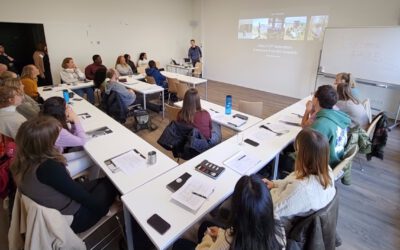
Today we welcomed the new generation of Earth Observation EAGLE students and are happy to see such a diverse and highly motivated group of students again. Students from Nepal, India, Ruanda or Turkey joint our study program among many other countries and already in...
MSc defense by Vanessa Rittlinger
On Friday,October 24, 2023 at 10:00 a.m. Vanessa Rittllinger will present her master thesis on “Detection of landslides in space and time using optical remote sensing data – A case study in South Tyrol” From the abstract: Landslides as a natural hazard cause damage...
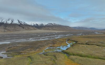
EAGLE MSc students working in the Arctic
From August to November, two EAGLE students had the opportunity to do their internship at the University Centre in Svalbard (UNIS), working in the department of Arctic Biology. Their tasks included regular drone flights in Adventdalen, a valley close to the world’s...
MSc defense by Narges Mohammadi Khoshouei
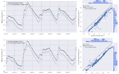
On October 06, 2023, Narges Mohammadi Khoshouei (Sanaz) successfully defended her master’s thesis entitled “Short-term forecast of water reservoir dynamics by integrating earth observation and hydrological modeling for dam management” at the Earth Observation Research...
MSc Defense by Narges Mohammadi Khoshouei
MSc Defense by Narges Mohammadi Khoshouei On Friday, October 09, 2023, at 10 a.m. Narges Mohammadi Khoshouei will present her MSc thesis "Short-term forecast of water reservoir dynamics by integrating earth observation and hydrological modeling for dam management" in...
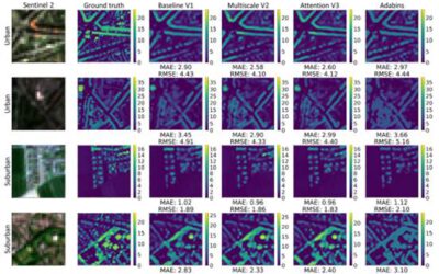
Our EAGLE student Konstantin published an article on deep neural network regression for digital surface model generation
Our EAGLE M.Sc. student Konstantin together with our EOR cluster professor and EAGLE lecturer Hannes Taubenböck published an article about the capabilities of deep neural network regression for digital surface model generation with Sentinel-2 Imagery. Konstantin...
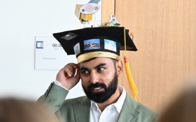
first EAGLE MSc. student defended his PhD
one of our very first EAGLE M.Sc. students Maninder Dhillon successfully defended his PhD! Congratulations by the whole EAGLE program and of course all EAGLE students - many of the young and older students joined his presentation and listened to his topic of...
M.Sc. defense by Luisa Pflumm on remote sensing for decision making
Luisa will defend her M.Sc. thesis "Using remote sensing to enhance conservation decision-making: The case of the little-known silver-backed chevrotain" this Friday at 10am in the meeting room John Skilton 4a. From her abstract: "Southeast Asia is a biodiverse region...
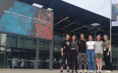
EAGLEs at DLR’s 4th Symposium “New Perspectives on Earth Observation”
From the 26th to the 28th of June, the fourth symposium on Applied Satellite Earth Observation, organized by the DLR took place in Bonn and some of the current EAGLE generation did not miss the opportunity to make a fun trip to the former capital of Germany. From...