Aim
The participants will get familiar with the methological skills and processing chain for the analysis of polarimetric synthetic aperture radar (PolSAR) and Polarimetric SAR Interferometry (PolInSAR) data.
Content
The module encompasses the following practical topics:
- Processing of sentinel-1 radar SLC and GRD data for retrieving the biophysical parameters of different crop types and soil.
- Processing of quad pol (full polarization) of RADARSAT2 satellite data and AIRSAR full polarimetric photogrammetric data acquired by airplane to get familiar with the decomposition concept.
- Processing of Tandem-X bistatic mode to retrieve the forest height and biomass.
General Course News and Updates
Article published by our EAGLE Laura Obrecht
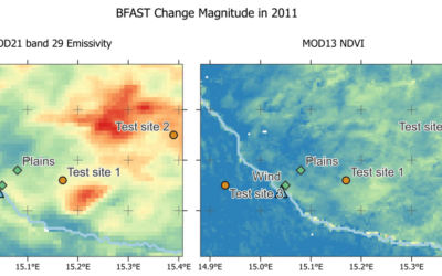
Just before the end of last year Lauras manuscript about fractional cover analysis in Namibia got published! Her research is titled "Mapping Changes in Fractional Vegetation Cover on the Namib Gravel Plains with Satellite-Retrieved Land Surface Emissivity Data"....

EAGLE Xmas party
After a bit more than 2 months of intense Earth Observation courses and lots of studying of radar, cloud computing, r and python programming and much more the EAGLEs are celebrating the end of the year and two weeks break before the second part of the winter terms...
EAGLEs presented their work in the Arctic and South Africa
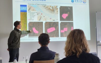
Today 5 of our EAGLE students presented their work in the past months in the Arctic using remote sensing data, space-borne and UAS, for ecological and conservation applications. Beside their very impressive scientific results did they also report on their general life...
EAGLEs at DLR DFD LAX
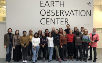
As part of the lecture by Claudia Künzer all EAGLEs of her course also visit the Earth Observation Center of DLR in Oberfpaffenhofen and listen to various talks by remote sensing scientists working in Oberpfaffenhofen: Patrick Sogno, an EAGLE alumni and also PhD...
EAGLE lecturer also training ESA astronauts on earth observation
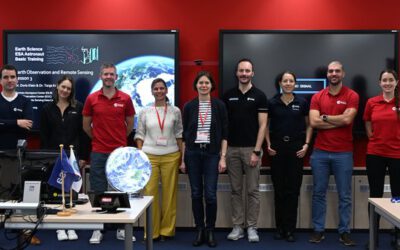
One of our EAGLE lecturer; Dr. Doris Klein, is not only teaching remote sensing to our international EAGLE students but also to future astronauts! Great to see that earth observation is also trained within other disciplines than our own specific remote sensing MSc....
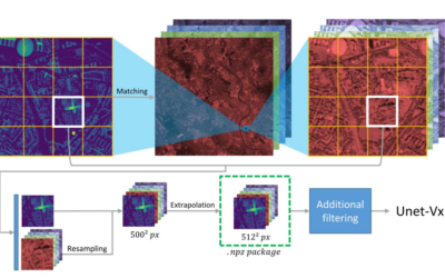
Deep Neural Network Regression for Normalized Digital Surface Model Generation with Sentinel-2 Imagery
Our EAGLE student Konstantin Müller published together with our chairholder of the Deparment of Global Urbanization and Remote Sensing, Hannes Taubenboeck an article about DL for surface model generation. The article explores methods to extract high-resolution...
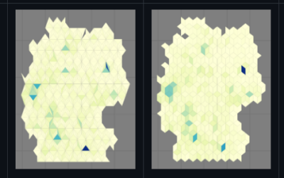
new QGIS plugin and R package
our EAGLE student Konstantin Müller created a QGIS plugin and a corresponding R package for easy point density vizualisation. Create way to learn how to build QGIS plugins and R package for spatial analysis. QGIS plugin: The Bestagon QGIS plugin allows easy density...
MSc defense by Joy Giovanni Matabishi
On Tuesday, October 31, 2023 at 12 a.m Joy-Giovanni Matabishi will present his Msc Thesis “Modelling Bat Distribution and Diversity with Artificial light as a Focal Predictor in South Tyrol” in the seminar room 3 in John-Skilton-Str. 4a/ground floor. Modelling Bat...
MSc defense by Vanessa Rittlinger
On Tuesday, October 24, 2023 at 12:00 a.m. Vanessa Rittllinger will present her master thesis on “Detection of landslides in space and time using optical remote sensing data – A case study in South Tyrol” in seminar room 3 in John-Skilton-Str. 4a/ground floor From the...
MSc defense by Moritz Rösch
On Tuesday, November 27 at 12:00 a.m., 2023 Moritz Rösch will present his MSc defense “Daily spread prediction of European wildfires based on historical burned area time series from Earth observation data using spatio-temporal graph neural networks” in the seminar...