Aim
Aim of this course is to provide you with an overview on geographic processes of urbanization, the related demographic and structural changes of cities, and data analyses methods using remote sensing data for applications in urban geography.
Content
Humankind is within its largest migration ever: from rural areas into cities. The drivers of this global process of urbanization from demographic to economic and the related structural changes cities are facing will be discussed in this course. Remote sensing is one crucial data source in this dynamic transformation and its products are highly relevant for urban planning, as well as environmental management. Within this course different approaches and techniques are covered focusing on deriving relevant information about urbanized areas on different levels of detail. Uni-temporal-, multi-temporal-, and time series based image classification, segmentation, the analyses of point patterns, GIS analyses to assess spatial context and dependencies, as well as analyses in the 3D domain will be addressed in this course. This will be done providing and discussing example applications from different regions globally (e.g. urban sprawl analysis of megacities, the development of new dimensions of urban landscapes such as mega-regions, the rearrangement of business districts within the urban landscape, etc.). You will learn what capabilities Earth observation data, methods and products have for urban research and applications and how to design remote sensing based urban analysis, how to avoid caveats, troubleshoot errors and interpret the results.
General Course News and Updates
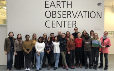
EAGLEs at DLR DFD LAX
As part of the lecture by Claudia Künzer all EAGLEs of her course also visit the Earth Observation Center of DLR in Oberfpaffenhofen and listen to various talks by remote sensing scientists working in Oberpfaffenhofen: Patrick Sogno, an EAGLE alumni and also PhD...
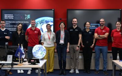
EAGLE lecturer also training ESA astronauts on earth observation
One of our EAGLE lecturer; Dr. Doris Klein, is not only teaching remote sensing to our international EAGLE students but also to future astronauts! Great to see that earth observation is also trained within other disciplines than our own specific remote sensing MSc....
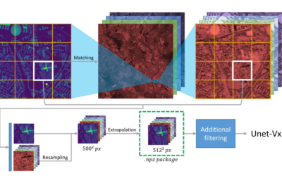
Deep Neural Network Regression for Normalized Digital Surface Model Generation with Sentinel-2 Imagery
Our EAGLE student Konstantin Müller published together with our chairholder of the Deparment of Global Urbanization and Remote Sensing, Hannes Taubenboeck an article about DL for surface model generation. The article explores methods to extract high-resolution...
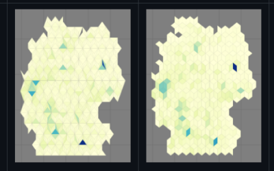
new QGIS plugin and R package
our EAGLE student Konstantin Müller created a QGIS plugin and a corresponding R package for easy point density vizualisation. Create way to learn how to build QGIS plugins and R package for spatial analysis. QGIS plugin: The Bestagon QGIS plugin allows easy density...
MSc defense by Joy Giovanni Matabishi
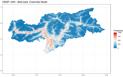
On Tuesday, October 31, 2023 at 12 a.m Joy-Giovanni Matabishi will present his Msc Thesis “Modelling Bat Distribution and Diversity with Artificial light as a Focal Predictor in South Tyrol” in the seminar room 3 in John-Skilton-Str. 4a/ground floor. Modelling Bat...
MSc defense by Vanessa Rittlinger
On Tuesday, October 24, 2023 at 12:00 a.m. Vanessa Rittllinger will present her master thesis on “Detection of landslides in space and time using optical remote sensing data – A case study in South Tyrol” in seminar room 3 in John-Skilton-Str. 4a/ground floor From the...
Internship Report
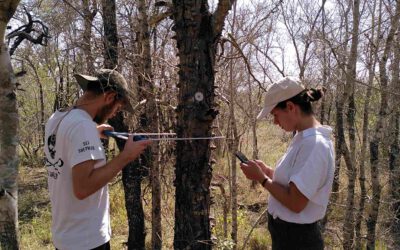
On Tuesday, December 12, 2023 at 12:00 a.m. Sunniva McKeever, Maximilian Merzdorf, and Isabella Metz will present their internship report on their internship at the Kruger National Park, South Africa in seminar room 3 in John-Skilton-Str. 4a/ground floor Subject: "Our...
MSc defense by Moritz Rösch
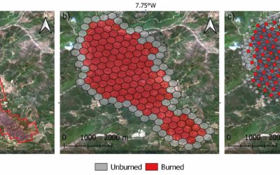
On Tuesday, November 27 at 12:00 a.m., 2023 Moritz Rösch will present his MSc defense “Daily spread prediction of European wildfires based on historical burned area time series from Earth observation data using spatio-temporal graph neural networks” in the seminar...
Internship Report by Christobal Tobbin
On Tuesday, November 28, 2023 at 13:00 Christobal Tobbin will present his internship report on his internship at DLR “The CONCERT Project” in seminar room 3 in John-Skilton-Str. 4a/ground floor. From the abstract: The CONCERT project with the Agriculture and...
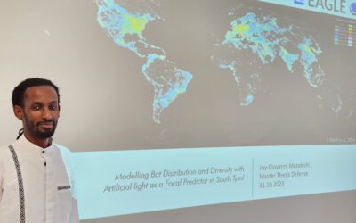
Successful MSc defense by Giovanni Matabishi
Giovanni presented his MSc thesis “Modelling Bat Distribution and Diversity with Artificial light as a Focal Predictor in South Tyrol” today within our EAGLE colloquium and passed successfully. He presented very interesting approaches of remote sensing for modelling...