EAGLEs high up in the mountains

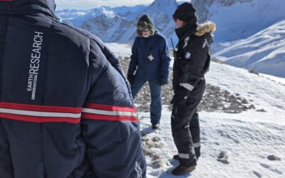
Some of our EAGLEs went up to the research station on the highest mountain of Germany to explore the research activities conducted in this area and discuss what remote sensing can contribute. The met ecologists, botanists and other disciplines and learned what Earth Observation can provide as crucial information for other research fields.
This visit will be the start of various trips up to the high mountains to explore the options of remote sensing in this landscape. 

read more news:

🗺 Exploring Map Visualizations

🗺 Exploring Map Visualizations

Within our EAGLE courses our students have to learn a wide variety of skills - beside the fundamental earth observation theory and practice also skills like map creation is part of the curriculum. One of our students Ronja Seitz has created three visualizations guides...

Course on Object-based image analysis

Course on Object-based image analysis

Dr. Michael Wurm from the German Aerospace Center (DLR) gave a class about Object-based image analysis (OBIA) using the eCognition Software for the EAGLE students. The course gives an insight into the theoretical basis of OBIA and using different datasets and tasks...