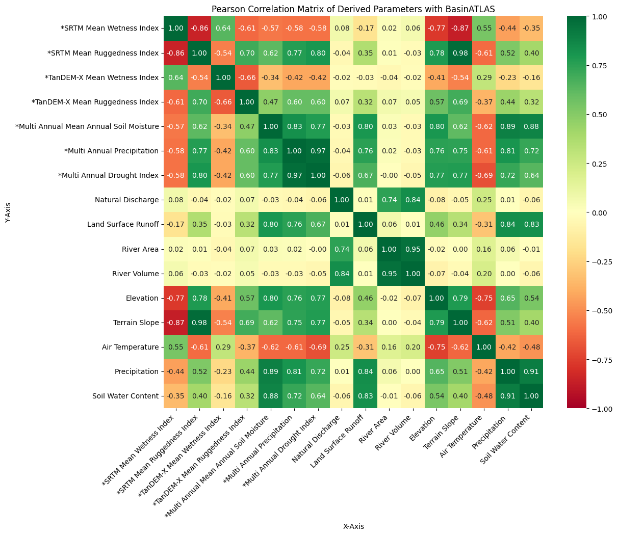
From the abstract: Climate change factors such as floods and droughts lead to hydrological effects that influence the intensity of catchment runoff, water flow, and quality. A global hydro-environmental dataset, HydroSHEDS v.2, is collaboratively developed by the German Aerospace Center (DLR), McGill University, Confluvio Consulting, and the World Wildlife Fund (WWF). This dataset provides consistent global coverage with a spatial resolution of 1 arc-second (30 meters), consisting of an underlying DEM known as TanDEM-X with a spatial resolution of 0.4 arc-second (12 meters). The aim was to develop and evaluate novel geomorphometric parameters at a sub-basin level for HydroSHEDS v.2 by utilizing geometries and the underlying DEM from the BasinATLAS dataset of HydroSHEDS v.1 and TanDEM-X, respectively. Geomorphometric parameters such as the Topographic Wetness Index (TWI), Terrain Ruggedness Index (TRI), and Geomorphons were computed from SRTM and TanDEM-X. In addition, Multi-Annual Grid datasets of Germany, such as Precipitation, Soil Moisture, and Drought Index from Deutscher Wetterdienst (DWD), are aggregated to the BasinATLAS dataset to explore their relationship with derived geomorphometric and existing parameters.
1st supervisor: Prof. Dr. Tobias Ullmann
Hosting institution: DLR


