On February 10, 2026, Laura Obrecht will present her internship results on ” Recommended Practices for Urban Flood Mapping in Emergency Response” at 12:00 in seminar room 3, John-Skilton-Str. 4a.type of presentation:
From the abstract: Flood detection in urban environments remains a major challenge for space-based remote sensing. Due to the geometric characteristics of urban fabric, conventional flood-mapping approaches using Synthetic Aperture Radar (SAR) backscatter often fail, as vertical structures such as buildings produce strong radar returns that obscure inundated areas.
During my internship at UN-SPIDER (United Nations Platform for Space-based Information for Disaster Management and Emergency Response) in Bonn, I addressed these limitations by developing three Recommended Practices for flood mapping using Sentinel satellite data and Digital Elevation Models. These practices are specifically tailored to the needs and constraints of emergency response teams in developing countries.
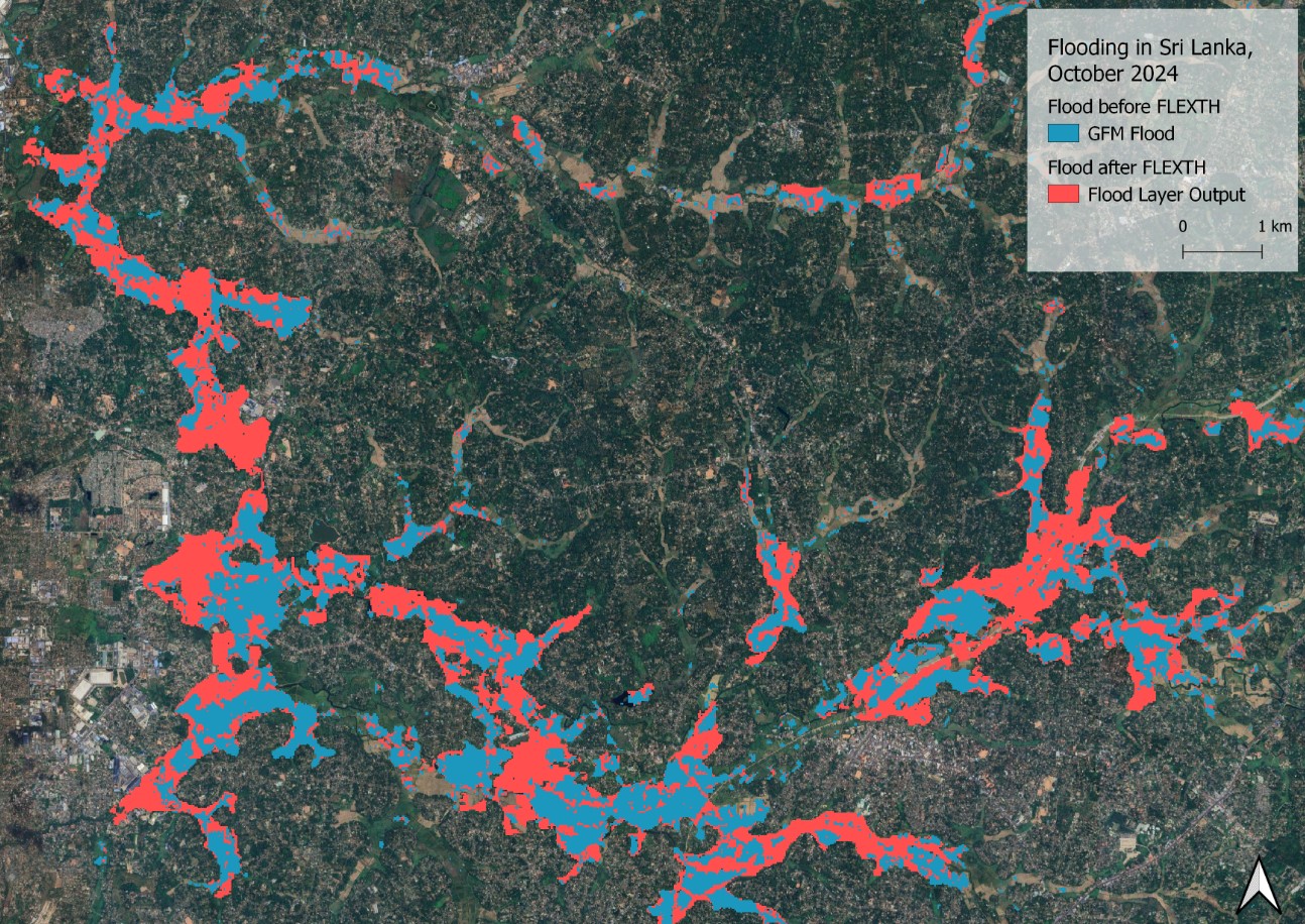
Flood extent was mapped through a combined use of Sentinel-2 optical imagery and Sentinel-1 SAR backscatter data. Sensor-specific limitation masks were applied, accounting for cloud cover in Sentinel-2 data and reduced performance in urban and densely vegetated areas for Sentinel-1 GRD data. A Digital Terrain Model was then used to propagate flood information into areas where direct satellite observation is unreliable or unavailable.
Using the October 2024 flood event in Valencia as a case study, I further developed a guideline for mapping urban floods based on Sentinel-1 InSAR coherence change detection, demonstrating its potential to improve flood monitoring in complex urban settings.
1st supervisor: Dr. Martin Wegmann Host: UN-SPIDER (Bonn)
From the abstract: Flood detection in urban environments remains a major challenge for space-based remote sensing. Due to the geometric characteristics of urban fabric, conventional flood-mapping approaches using Synthetic Aperture Radar (SAR) backscatter often fail, as vertical structures such as buildings produce strong radar returns that obscure inundated areas.
During my internship at UN-SPIDER (United Nations Platform for Space-based Information for Disaster Management and Emergency Response) in Bonn, I addressed these limitations by developing three Recommended Practices for flood mapping using Sentinel satellite data and Digital Elevation Models. These practices are specifically tailored to the needs and constraints of emergency response teams in developing countries.
Flood extent was mapped through a combined use of Sentinel-2 optical imagery and Sentinel-1 SAR backscatter data. Sensor-specific limitation masks were applied, accounting for cloud cover in Sentinel-2 data and reduced performance in urban and densely vegetated areas for Sentinel-1 GRD data. A Digital Terrain Model was then used to propagate flood information into areas where direct satellite observation is unreliable or unavailable.
Using the October 2024 flood event in Valencia as a case study, I further developed a guideline for mapping urban floods based on Sentinel-1 InSAR coherence change detection, demonstrating its potential to improve flood monitoring in complex urban settings.
1st supervisor: Dr. Martin Wegmann Host: UN-SPIDER (Bonn)







![[spotlight] Lecturer Spotlight: Martin Wegmann](https://eagle-science.org/wp-content/uploads/2026/07/Martin_Wegmann_EAGLE_lecture_2026-400x250.jpg)