
On March 03, 2026, Lutz Kleemann will present his Innolab results on “From UAV to Satellite: Fractional Snow Cover Estimation at Sentinel-2 Resolution” at 12:00 in seminar room 3, John-Skilton-Str. 4a.
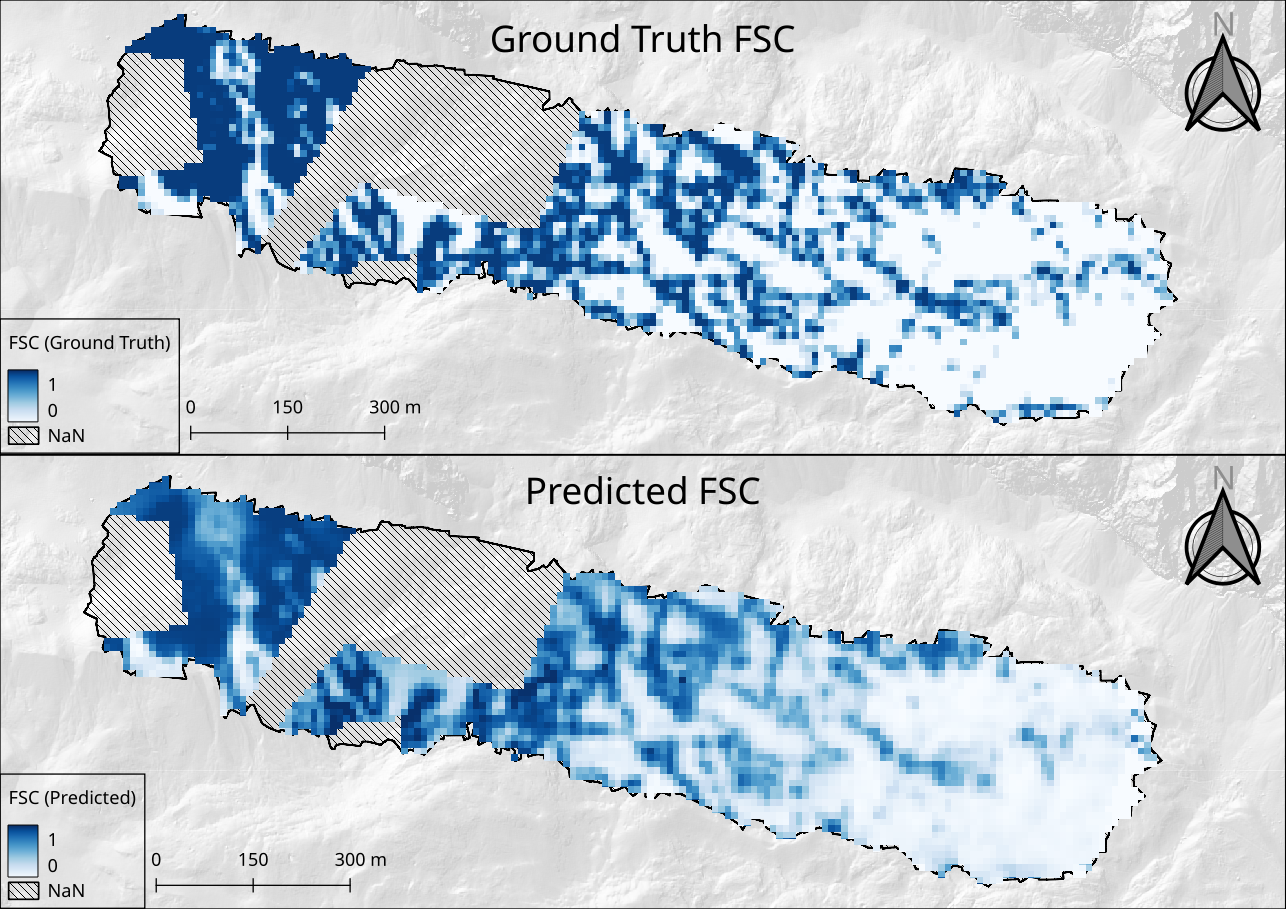
From the abstract: Fractional Snow Cover (FSC) estimation is an important remote sensing task for accurately quantifying snow cover from optical satellite imagery. The work of this Innolab focused on developing machine learning based approaches to predict FSC over the Zugspitzplatt using Sentinel-2 spectral bands. The models were trained using FSC reference data derived from high-resolution, multitemporal optical UAV imagery. The UAV datasets were processed to generate binary snow cover maps which then were spatially aggregated to derive FSC at the Sentinel-2 pixel scale (10m) and used as reference data for model training and evaluation. Spectral bands, snow-related indices and terrain variables were introduced as predictors for FSC estimation. Multiple Random Forest Regressors as well as a Support Vector Regressors were trained to predict FSC at Sentinel-2 pixel level. Model performance was evaluated using an independent high-quality UAV scene with the Random Forest Regressor achieving R² values of up to 0.72 and RMSE of up to 0.22. The Support Vector Regressor showed performances up to R² values of 0.78 and RMSE of 0.2. As performance was assessed on a single independent validation scene, these metrics should be interpreted as scene-specific estimates and may not fully represent generalization across different environmental conditions.
1st supervisor: Elio Rauth 2nd (external) supervisor: Bais Tufail
From the abstract: Fractional Snow Cover (FSC) estimation is an important remote sensing task for accurately quantifying snow cover from optical satellite imagery. The work of this Innolab focused on developing machine learning based approaches to predict FSC over the Zugspitzplatt using Sentinel-2 spectral bands. The models were trained using FSC reference data derived from high-resolution, multitemporal optical UAV imagery. The UAV datasets were processed to generate binary snow cover maps which then were spatially aggregated to derive FSC at the Sentinel-2 pixel scale (10m) and used as reference data for model training and evaluation. Spectral bands, snow-related indices and terrain variables were introduced as predictors for FSC estimation. Multiple Random Forest Regressors as well as a Support Vector Regressors were trained to predict FSC at Sentinel-2 pixel level. Model performance was evaluated using an independent high-quality UAV scene with the Random Forest Regressor achieving R² values of up to 0.72 and RMSE of up to 0.22. The Support Vector Regressor showed performances up to R² values of 0.78 and RMSE of 0.2. As performance was assessed on a single independent validation scene, these metrics should be interpreted as scene-specific estimates and may not fully represent generalization across different environmental conditions.
1st supervisor: Elio Rauth 2nd (external) supervisor: Bais Tufail




![[Spotlight] Lecturer Spotlight: Julian Faeth](https://eagle-science.org/wp-content/uploads/2026/10/Julian_Faeth_EORC_EAGLE_2026-400x250.jpg)



