
On February 10, 2026, Mahnoor Nadeem will present her Innolab results on ” Gap-Filling Optical NDVI Using SAR-Derived Indices and Machine Learning” at 12:00 in seminar room 3, John-Skilton-Str. 4a.
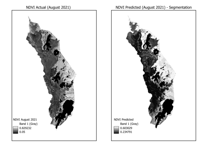
From the abstract: Normalized Difference Vegetation Index (NDVI) is widely used to monitor vegetation dynamics. However, the applicability of NDVI is limited widely in tropical areas due to the persistent cloud cover throughout the year. This project explores the use of Sentinel-1 SAR data derived indices to calculate NDVI. Sentinel-1 VV and VH backscatter imagery was used to calculate twelve indices. These indices, along with the Digital Elevation Model (DEM) of the study area were used to train a Random Forest regression model. Image segmentation was applied to aggregate SAR features prior to model training and prediction. The model was trained using cloud-free data from July 2021 and subsequently applied to July 2022 and August 2021 to assess its performance under unseen conditions. The prediction validation was done NDVI derived from Sentinel-2 imagery for the corresponding periods and a model accuracy of 60% was achieved. The segment based approach improved spatial smoothness in the predicted NDVI maps. However, fine scale details were lost. In addition, the model showed a tendency to underestimate NDVI extremes, particularly in areas of dense vegetation. Lecturer to be present: Dr. Insa Otte
2nd lecturer: Sebastian Buchelt
From the abstract: Normalized Difference Vegetation Index (NDVI) is widely used to monitor vegetation dynamics. However, the applicability of NDVI is limited widely in tropical areas due to the persistent cloud cover throughout the year. This project explores the use of Sentinel-1 SAR data derived indices to calculate NDVI. Sentinel-1 VV and VH backscatter imagery was used to calculate twelve indices. These indices, along with the Digital Elevation Model (DEM) of the study area were used to train a Random Forest regression model. Image segmentation was applied to aggregate SAR features prior to model training and prediction. The model was trained using cloud-free data from July 2021 and subsequently applied to July 2022 and August 2021 to assess its performance under unseen conditions. The prediction validation was done NDVI derived from Sentinel-2 imagery for the corresponding periods and a model accuracy of 60% was achieved. The segment based approach improved spatial smoothness in the predicted NDVI maps. However, fine scale details were lost. In addition, the model showed a tendency to underestimate NDVI extremes, particularly in areas of dense vegetation. Lecturer to be present: Dr. Insa Otte
2nd lecturer: Sebastian Buchelt




![[Spotlight] Lecturer Spotlight: Julian Faeth](https://eagle-science.org/wp-content/uploads/2026/10/Julian_Faeth_EORC_EAGLE_2026-400x250.jpg)



