
On June 10, 2025, Christobal Tobbin will present his Master Thesis on ” Enhancing Land Cover Classification in Southern Africa Using Multi-Sensor and Multi-Algorithm Approaches”
at 12:00 online.
From the abstract:
The Kavango-Zambezi (KAZA) region which is a part of the Transfrontier Conservation Areas (TFCAs) aims at promoting biodiversity conservation and socioeconomic development across borders. However, there has been a rapid increase in land transformation within the region through agricultural expansion, which has led to increased human-wildlife conflicts (HWC) and threatening the objectives of these conservation areas. This thesis seeks to map and monitor such agricultural transformation with focus on the Binga District. The study leverages traditional Machine Learning (ML) classification and modern deep learning approaches, specifically the Segment Anything Model (SAM) developed by Meta AI. Sentinel-2 and high-resolution PlanetScope satellite imagery were employed to classify and delineate agricultural fields within Binga District. AutoSklearn, an automated ML framework was used to classify and differentiate between agriculture and non-agricultural areas, highlighting challenges in binary classification and the high computational runtime required to optimize model performance and results. The results indicate that Sentinel-2’s multi-spectral capabilities contributed to a more accurate land cover classification.
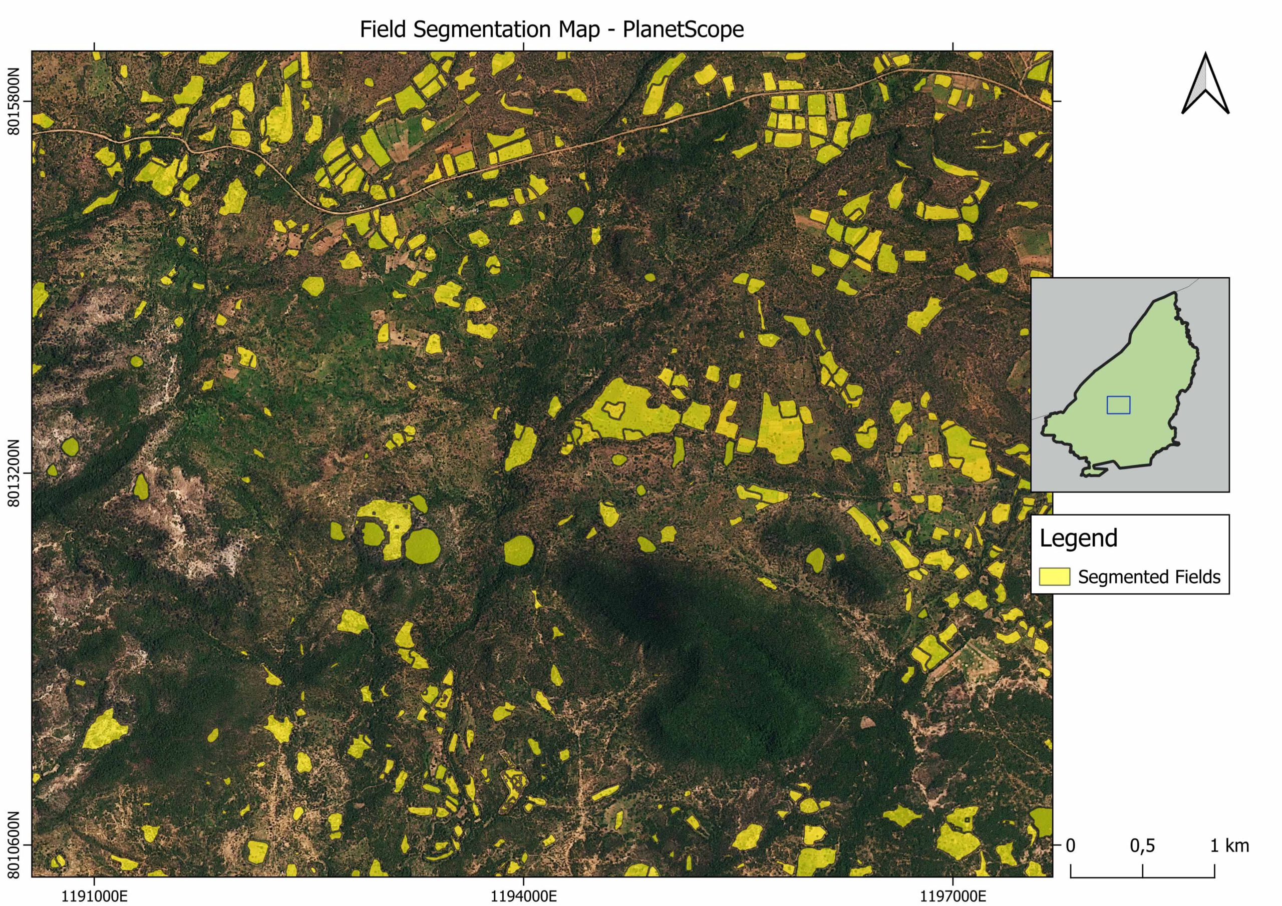
SAM was used to delineate agricultural fields using both satellite imagery, demonstrating the importance of spatial resolution in field segmentation, with PlanetScope’s higher spatial resolution yielding better segmentation results. The study also explores the use of harmonic composites to potentially enhance the quality of field segmentations. Overall, the integration of traditional ML and modern deep learning approaches in this study contributes to a deeper understanding of land-use change and illustrates how land cover classification can be enhanced by using multi-sensor and multi-algorithm approaches. Future studies can explore the integration of additional models and the temporal dynamics of land transformation to further refine the results.
1st supervisors: Dr. Martin Wegmann
2nd (external) supervisor: Nuno César de Sá, WWF




![[Spotlight] Lecturer Spotlight: Julian Faeth](https://eagle-science.org/wp-content/uploads/2026/10/Julian_Faeth_EORC_EAGLE_2026-400x250.jpg)



