
On May 20, 2025, Sunniva McKeever will present her Master thesis on ” Spatio-temporal Forest Structure Dynamics in Germany: A Synthesis of Remote Sensing Products” at 12:00 in seminar room 3, John-Skilton-Str. 4a.
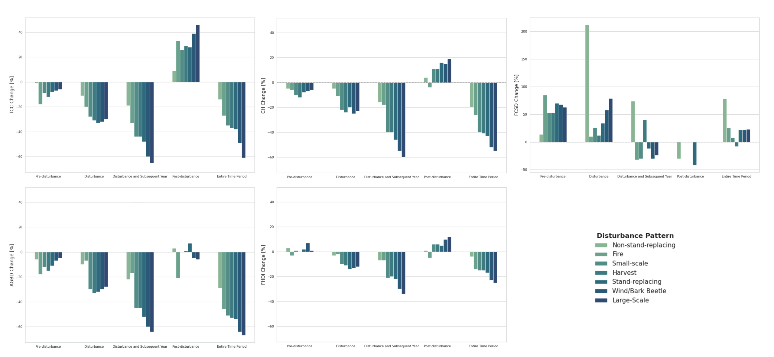
From the abstract: Germany’s forests have experienced unprecedented structural changes in recent years, largely driven by the 2018–2020 drought and a subsequent rise in disturbances such as windstorms, bark beetle outbreaks and forest fires. This thesis presents a high-resolution, spatio-temporal analysis of forest structure dynamics in Germany from 2017 to 2023 by synthesising three remote sensing products provided by the German Aerospace Center. Disturbance patterns are identified and linked with structural data to reveal insights into forest dynamics — from pre-disturbance vulnerabilities to immediate impacts and post-disturbance recovery. The findings show that forest structural changes vary significantly with prevailing disturbance regimes. This study highlights the potential of remote sensing to support adaptive forest management, improve forest inventories and enable early-warning systems by detecting stress indicators before visible damage occurs. It also enhances understanding of forest regeneration and offers guidance for targeted reforestation to strengthen ecosystem resilience in the face of ongoing environmental change.
1st supervisor: Prof. Dr. Tobias Ullmann
2nd (external) supervisor: Dr. Frank Thonfeld
From the abstract: Germany’s forests have experienced unprecedented structural changes in recent years, largely driven by the 2018–2020 drought and a subsequent rise in disturbances such as windstorms, bark beetle outbreaks and forest fires. This thesis presents a high-resolution, spatio-temporal analysis of forest structure dynamics in Germany from 2017 to 2023 by synthesising three remote sensing products provided by the German Aerospace Center. Disturbance patterns are identified and linked with structural data to reveal insights into forest dynamics — from pre-disturbance vulnerabilities to immediate impacts and post-disturbance recovery. The findings show that forest structural changes vary significantly with prevailing disturbance regimes. This study highlights the potential of remote sensing to support adaptive forest management, improve forest inventories and enable early-warning systems by detecting stress indicators before visible damage occurs. It also enhances understanding of forest regeneration and offers guidance for targeted reforestation to strengthen ecosystem resilience in the face of ongoing environmental change.
1st supervisor: Prof. Dr. Tobias Ullmann
2nd (external) supervisor: Dr. Frank Thonfeld




![[Spotlight] Lecturer Spotlight: Julian Faeth](https://eagle-science.org/wp-content/uploads/2026/10/Julian_Faeth_EORC_EAGLE_2026-400x250.jpg)



