
On March 27, 2026, Max Merzdorf will present his Master Thesis on ” Assessing the potential of multispectral UAS and PlanetScope imagery for estimating vegetation structure and biodiversity metrics in urban green spaces” at 12:30 at the meeting room 01.B03 (first floor), John-Skilton-Str. 4a.
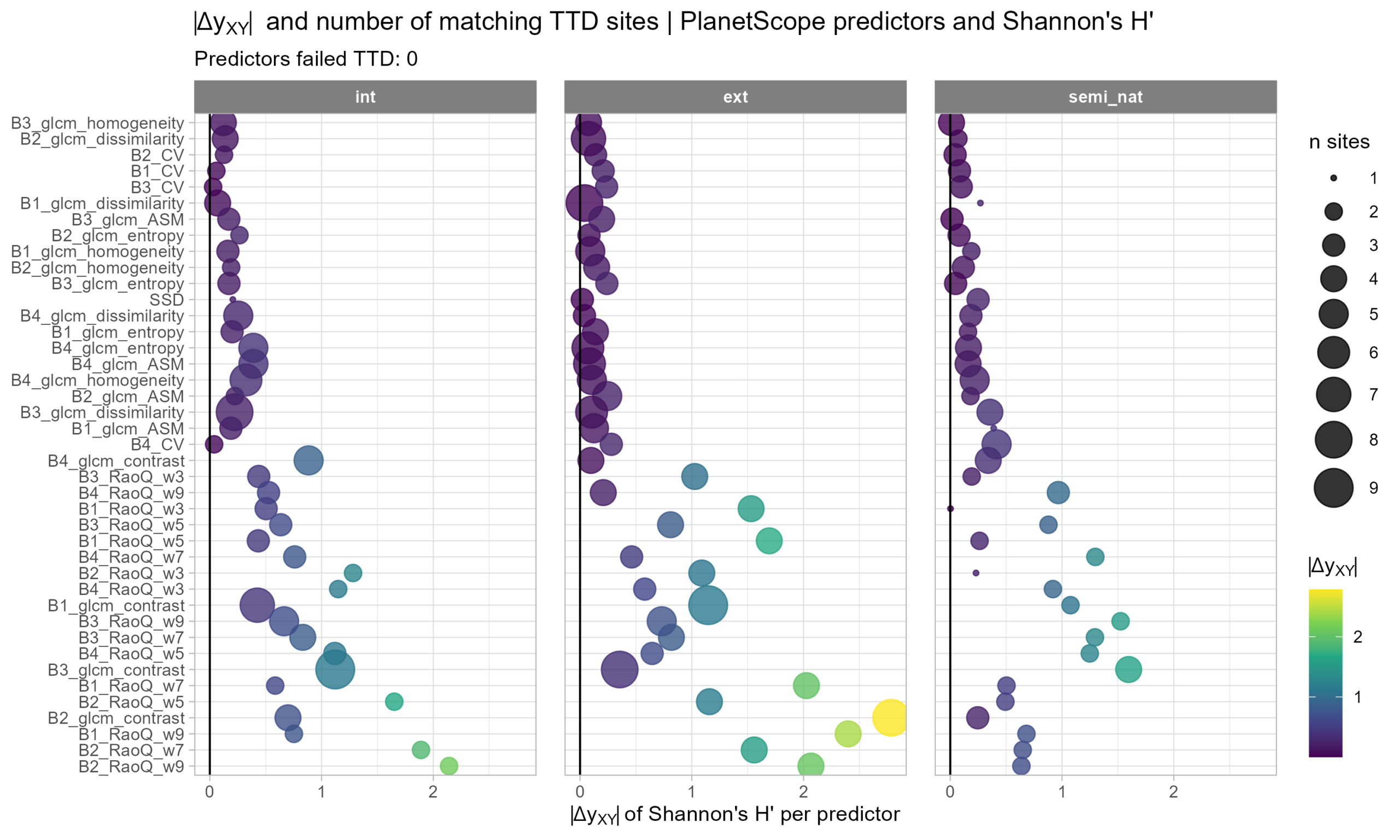
From the abstract: Biodiversity and vegetation structure are important indicators of ecosystem health and resilience. Monitoring these variables is challenging due to labour-intensive fieldwork and spatial heterogeneity. Remote sensing offers promising and accessible solutions, particularly through multispectral satellite imagery and unmanned aerial systems (UAS). Hyperspectral sensors provide high spectral resolution but they are expensive and complex in operation. Multispectral UAS and satellite platforms such as PlanetScope are more accessible. This thesis investigated the potential of multispectral UAS and PlanetScope data to estimate biodiversity and vegetation structure in urban grasslands using spectral diversity and texture metrics. Field data on species composition and vegetation structure across 30 urban grassland sites in Würzburg, Germany, was complemented by UAS data at 3 cm, 6 cm and 12 cm resolution, as well as PlanetScope data at 3 m resolution. Biodiversity variables included species richness, Shannon diversity and species turnover, while structure variables included vegetation height and fractional cover of vegetation types. Remote sensing predictors included established spectral diversity metrics such as coefficient of variation (CV) and spectral space distance (SSD). Additionally we tested gray-level co-occurrence matrix (GLCM) texture metrics such as homogeneity, contrast, entropy, and dissimilarity. Predictor performance was assessed using two approaches: (i) temporal trend direction (TTD) to evaluate the direction of change and (ii) differences of slopes (∆yXY ) to evaluate the magnitude of change. Prediciton of structure variables were assessed with Pearson’s correlation coefficient. Results demonstrate that both multispectral UAS and PlanetScope imagery can estimate relative biodiversity measures, with CV and SSD providing the most robust performance across site management types and resolutions.
1st supervisors: Dr. Sarah Schönbrodt-Stitt
2nd (external) supervisor: Jun-Prof.in Nadja Simons
From the abstract: Biodiversity and vegetation structure are important indicators of ecosystem health and resilience. Monitoring these variables is challenging due to labour-intensive fieldwork and spatial heterogeneity. Remote sensing offers promising and accessible solutions, particularly through multispectral satellite imagery and unmanned aerial systems (UAS). Hyperspectral sensors provide high spectral resolution but they are expensive and complex in operation. Multispectral UAS and satellite platforms such as PlanetScope are more accessible. This thesis investigated the potential of multispectral UAS and PlanetScope data to estimate biodiversity and vegetation structure in urban grasslands using spectral diversity and texture metrics. Field data on species composition and vegetation structure across 30 urban grassland sites in Würzburg, Germany, was complemented by UAS data at 3 cm, 6 cm and 12 cm resolution, as well as PlanetScope data at 3 m resolution. Biodiversity variables included species richness, Shannon diversity and species turnover, while structure variables included vegetation height and fractional cover of vegetation types. Remote sensing predictors included established spectral diversity metrics such as coefficient of variation (CV) and spectral space distance (SSD). Additionally we tested gray-level co-occurrence matrix (GLCM) texture metrics such as homogeneity, contrast, entropy, and dissimilarity. Predictor performance was assessed using two approaches: (i) temporal trend direction (TTD) to evaluate the direction of change and (ii) differences of slopes (∆yXY ) to evaluate the magnitude of change. Prediciton of structure variables were assessed with Pearson’s correlation coefficient. Results demonstrate that both multispectral UAS and PlanetScope imagery can estimate relative biodiversity measures, with CV and SSD providing the most robust performance across site management types and resolutions.
1st supervisors: Dr. Sarah Schönbrodt-Stitt
2nd (external) supervisor: Jun-Prof.in Nadja Simons




![[Spotlight] Lecturer Spotlight: Julian Faeth](https://eagle-science.org/wp-content/uploads/2026/10/Julian_Faeth_EORC_EAGLE_2026-400x250.jpg)



