
On September 23, 2025, Elly Schmid will present her Master Thesis on ” Urban Flood Detection and Analysis Using SAR and CNN-Based Methods: A Case Study for Central Vietnam” at 12:00 in seminar room 3, John-Skilton-Str. 4a.
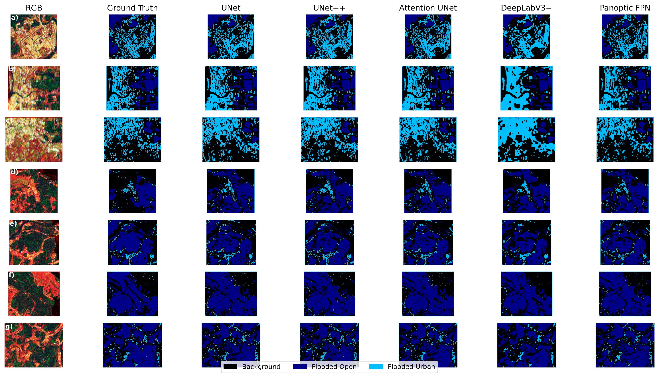
From the abstract: With over half of the world’s population residing in cities and many located in vulnerable coastal zones, urban flooding has become an increasingly pressing issue, especially in rapidly urbanizing regions. As sea level rises and extreme weather events intensify with climate change, the need for a timely, cost-effective flood detection is critical, particularly in areas with limited access to high-resolution satellite data or in-situ data. Despite this urgency, flood mapping in lower-income coastal urban areas remains significantly underrepresented in current satellite-based flood products. Vietnam, despite its high flood exposure, is rarely used as a study area in this context. This work assessed the applicability of a semiautomatic hierarchical-split-based approach (HSBA) for generating flood labels and the performance of five deep learning architectures with different sets of Input-Data for mapping flood extents trained on Sentinel-1 SAR data. The HSBA method proved effective in capturing urban and non-urban flood extents, though label accuracy was sometimes limited by the spatial resolution of SAR data and complex backscatter behaviour in certain land cover types. Among the tested models, U-Nets consistent-ly outperformed others, especially when combining multiple SAR bands with an urban probability mask, achieving high accuracy in the Vietnam test-case However, generalization to a different geo-graphic region revealed challenges in transferability, underscoring the need for more diverse training datasets and improved label quality. The findings demonstrate the potential of combining semi-automatic label generation with deep learning for flood mapping in data-scarce coastal urban areas and outline future directions for enhancing accuracy, efficiency, and robustness of such models.
1st supervisor: Prof. Dr. Claudia Künzer
2nd (external) supervisor: Dr. Felix Bachofer
From the abstract: With over half of the world’s population residing in cities and many located in vulnerable coastal zones, urban flooding has become an increasingly pressing issue, especially in rapidly urbanizing regions. As sea level rises and extreme weather events intensify with climate change, the need for a timely, cost-effective flood detection is critical, particularly in areas with limited access to high-resolution satellite data or in-situ data. Despite this urgency, flood mapping in lower-income coastal urban areas remains significantly underrepresented in current satellite-based flood products. Vietnam, despite its high flood exposure, is rarely used as a study area in this context. This work assessed the applicability of a semiautomatic hierarchical-split-based approach (HSBA) for generating flood labels and the performance of five deep learning architectures with different sets of Input-Data for mapping flood extents trained on Sentinel-1 SAR data. The HSBA method proved effective in capturing urban and non-urban flood extents, though label accuracy was sometimes limited by the spatial resolution of SAR data and complex backscatter behaviour in certain land cover types. Among the tested models, U-Nets consistent-ly outperformed others, especially when combining multiple SAR bands with an urban probability mask, achieving high accuracy in the Vietnam test-case However, generalization to a different geo-graphic region revealed challenges in transferability, underscoring the need for more diverse training datasets and improved label quality. The findings demonstrate the potential of combining semi-automatic label generation with deep learning for flood mapping in data-scarce coastal urban areas and outline future directions for enhancing accuracy, efficiency, and robustness of such models.
1st supervisor: Prof. Dr. Claudia Künzer
2nd (external) supervisor: Dr. Felix Bachofer




![[Spotlight] Lecturer Spotlight: Julian Faeth](https://eagle-science.org/wp-content/uploads/2026/10/Julian_Faeth_EORC_EAGLE_2026-400x250.jpg)



