
Understanding the environmental consequences of conflict is one of the most pressing challenges in contemporary Earth observation. During her internship at WWF, EAGLE MSc student Viktoria Veith has been working at the intersection of remote sensing, policy, and biodiversity—contributing to a timely and important initiative: the Ukraine chapter of the Feuerkompass publication series.
Mapping Fire and War: A Remote Sensing Perspective
As part of the “Policy and Biodiversity” team, Viktoria supports the development of a new Feuerkompass chapter focused on war-related vegetation fires and ecological destruction in Ukraine. The objective is clear yet ambitious: to bring ecological damage into the political spotlight alongside the human suffering caused by the ongoing war.
Her work is deeply rooted in geospatial data analysis. Using fire data products such as EFFIS, Viktoria explores and maps burned areas across Ukraine. Building on existing WWF workflows, she uses the programming language R to generate time series and compare national fire records with satellite-based detections.
Beyond mapping, her tasks include:
-
Conducting statistical analyses on fire area, fire frequency, and emissions
-
Translating results into tables, graphics, and maps
-
Investigating Ukraine-specific environmental and socio-political contexts
-
Performing literature reviews to support the scientific narrative
This combination of quantitative analysis and contextual research highlights the interdisciplinary nature of modern remote sensing applications.
From Analysis to Communication
A particularly valuable aspect of Viktoria’s internship has been her immersion in WWF’s full production workflow. Rather than focusing solely on data analysis, she has been involved in every stage of creating a Feuerkompass chapter—from initial research and coding to writing, infographic design, layout, and communication.
Regular team meetings foster collaboration and knowledge exchange, not only within her immediate group but also with WWF teams worldwide. This global perspective underscores the importance of coordinated efforts in addressing environmental crises.
The Feuerkompass itself is a modular and continuously evolving publication series. Existing chapters cover regions such as Germany and the Mediterranean, as well as global wildfire dynamics. The Ukraine chapter is scheduled for release this summer, alongside a complementary data report titled Satellite Data in Global Fire Monitoring, which documents the remote sensing methodologies behind the analyses.
Experiencing Impact Firsthand
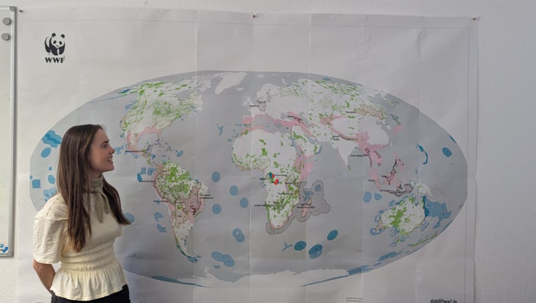
During her internship, Viktoria also had the opportunity to visit Berlin for WWF’s annual staff day. There, the Earth Observation team showcased the real-world impact of geodata through an interactive experience built with ArcGIS.
The highlight was the “Global Heartbeat” dashboard—an engaging tool where staff members could input their location and visualize their collective global footprint in real time. This digital experience was complemented by a large physical map, where participants marked their personal “Heartbeat Place for Biodiversity” using color-coded stickers representing WWF’s strategic goals.
Bridging Science and Policy
Viktoria’s internship exemplifies how remote sensing can inform policy and raise awareness of environmental destruction in conflict zones. By combining satellite data, statistical analysis, and storytelling, her work contributes to a growing body of evidence that ecological impacts must be considered an integral part of geopolitical crises.
Her experience highlights not only the technical skills developed during the EAGLE MSc program, but also the importance of translating scientific insights into meaningful communication—ensuring that data-driven evidence reaches decision-makers and the broader public alike.




![[Spotlight] Lecturer Spotlight: Julian Faeth](https://eagle-science.org/wp-content/uploads/2026/10/Julian_Faeth_EORC_EAGLE_2026-400x250.jpg)



