About
Courses
- Advanced spatial python
- Urban forms & society

Recent News

EAGLE M.Sc. idea presentations
On Monday, 24th of September from 1:30 onwards the following EAGLE students will present their M.Sc. idea. Everybody is welcome to join their presentations and to provide feedback: Julia: "Time-Series Analysis of Sentinel-1 and Sentinel-2...
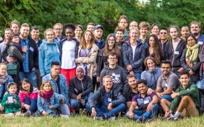
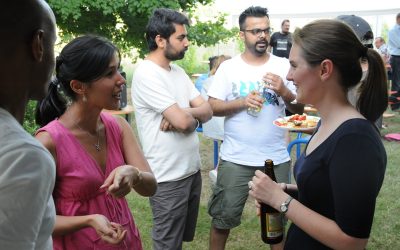
EAGLE summer dialogue 2018
Our 2018 EAGLE summer dialogue took place last Friday, 22nd of June and was a great place to meet all students, lectures, staff of the department and quite some external guests from all around Europe.
application deadline is approaching – May 15th
the application deadline for our next term of the international M.Sc. program EAGLE “applied Earth Observation and Geoanalysis of the Living Environment” is approaching. Application for the upcoming winter term are accepted until May 15th
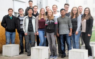
EAGLE 2017 students
Our new EAGLEs arrived and started their M.Sc. on Applied Earth Observation. During the official welcome all new students were introduced to the lecturer and the EAGLE students board. A joint dinner allowed to get to know everybody and address a...

Winter term 2017 is about to start
While the "old" EAGLEs are spending their 3rd term doing internships or innovation laboratories in Italy, Portugal, Poland or Burkina Faso at various research organizations or companies, the new EAGLEs for the winter term 2017/2018 will be welcomed next week. The...
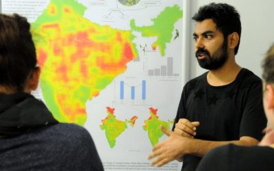
final course presentations
Our EAGLE students had to present their work as posters, reports or oral presentations at the end of the summer term and could show impressive achievements and results of small research projects.Some impressions of their oral and poster presentations can...
First EAGLE Midsummer Dialogue
Beside participants from the University of Wuerzburg and the DLR, also many colleagues from companies and a variety of national and international research institutions joined this event. The midsummer dialogue was organized by the EAGLE students. The students were...

application deadline in 7 days
The application deadline for the upcoming winter term is approaching. Apply within the next 7 days here: http://eagle-science.org/apply - application deadline is May 15th, further details about needed documents are listed on the application page. Learn within EAGLE...
application deadline for winter term 2017 is approaching
Applications for the EAGLE M.Sc. program are accepted until May 15th 2017 for the next winter term. The next application deadline will be only next year, again on May 15th 2018. You need the following documents for your application: a cover letter stating your...
EAGLE students webpage is now online
Our EAGLE students setup their own webpage at http://students.eagle-science.org! Read about their background, motivation and expectations concerning the EAGLE M.Sc. study program. Moreover, the EAGLE students will post news about ongoing social as well as scientific...
Our Courses
No Results Found
The page you requested could not be found. Try refining your search, or use the navigation above to locate the post.