On Tuesday, April 30 Konstantin Müller will present his internship ” GDELT News Analysis of the Noto Earthquake via ERNIE” at 14:00 in 01.B.03, John-Skilton-Str. 4a. :
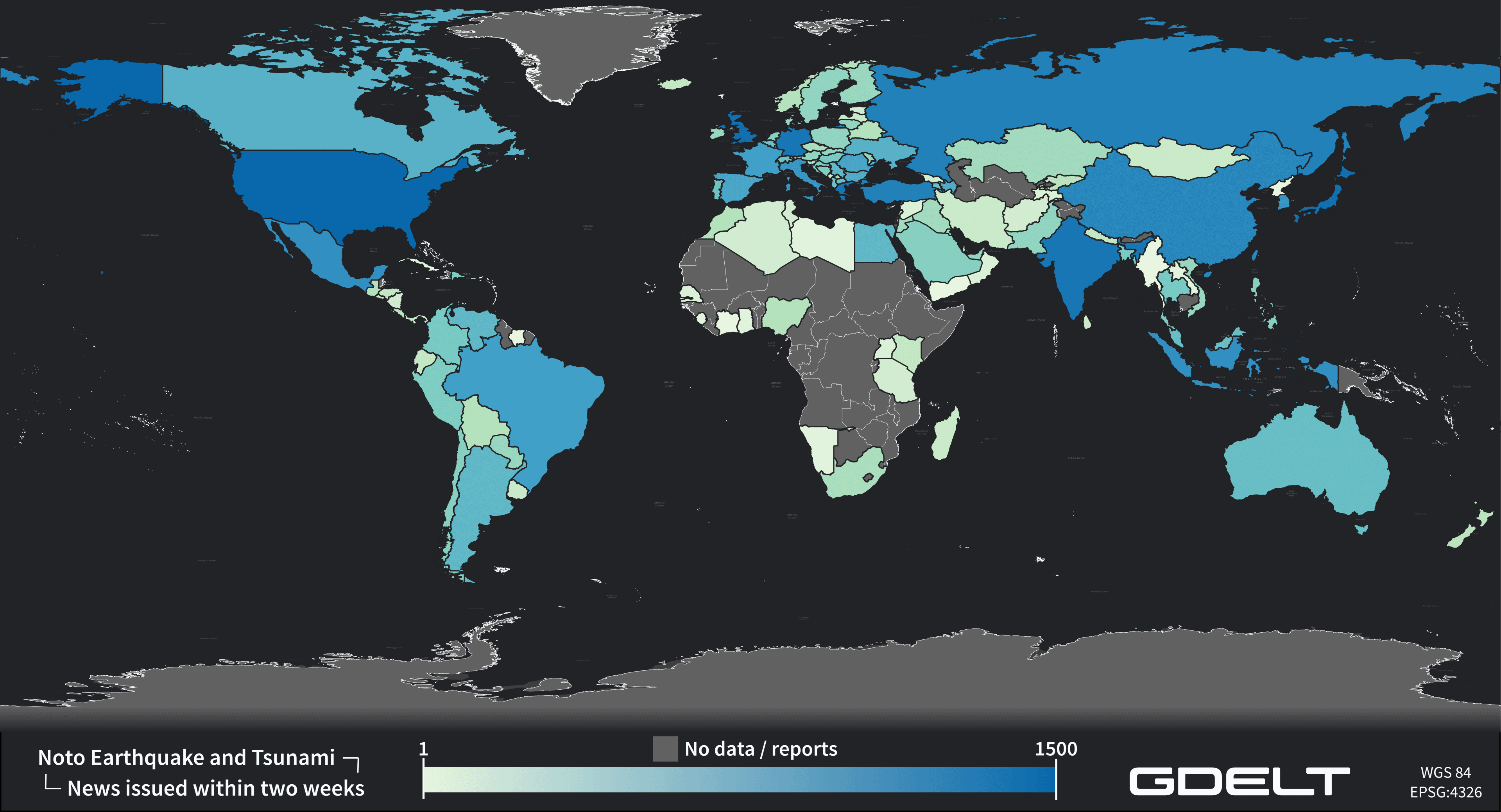
From the abstract: The analysis of socioeconomic data has gained increasing importance. The exchange of information, particularly through news agencies and magazines, shapes public perception and guides daily decision-making. This process is further amplified during significant events like natural disasters. The International Research Institute of Disaster Science (IRIDeS) focuses on investigating not only the environmental aspects of disasters but also their societal impacts, both locally and globally. In collaboration with IRIDeS, this internship explores the potential of utilizing a self-built pipeline named ERNIE to model and analyze the global social data source, GDELT. ERNIE facilitates the efficient integration of GDELT data relevant to IRIDeS’ field of expertise – particularly natural disasters – for future projects. Subsequently, the constructed pipeline is employed to analyze the publicly available GDELT news data pertaining to the Noto Peninsula Earthquake in Japan, which struck on January 1st.
Supervisor: Prof. Dr. Hannes Taubenböck
Hosting Institution: International Research Institute of Disaster Science (IRIDeS)
From the abstract: The analysis of socioeconomic data has gained increasing importance. The exchange of information, particularly through news agencies and magazines, shapes public perception and guides daily decision-making. This process is further amplified during significant events like natural disasters. The International Research Institute of Disaster Science (IRIDeS) focuses on investigating not only the environmental aspects of disasters but also their societal impacts, both locally and globally. In collaboration with IRIDeS, this internship explores the potential of utilizing a self-built pipeline named ERNIE to model and analyze the global social data source, GDELT. ERNIE facilitates the efficient integration of GDELT data relevant to IRIDeS’ field of expertise – particularly natural disasters – for future projects. Subsequently, the constructed pipeline is employed to analyze the publicly available GDELT news data pertaining to the Noto Peninsula Earthquake in Japan, which struck on January 1st.
Supervisor: Prof. Dr. Hannes Taubenböck
Hosting Institution: International Research Institute of Disaster Science (IRIDeS)







![[spotlight] Lecturer Spotlight: Martin Wegmann](https://eagle-science.org/wp-content/uploads/2026/07/Martin_Wegmann_EAGLE_lecture_2026-400x250.jpg)