About
Julian is a forest scientist and PostDoc at the Department of Remote Sensing at the University of Würzburg (JMU). He leads the working package ” forestry” within the EO4CAM project, focusing on remote-sensing-based assessment of forest condition, water balance, and climate resilience. His background includes several years of research at the Department of Physical Geography at the JMU and at the Professorship of Forest Nutrition and Water Resources at the Technical University of Munich, where he also completed his PhD. His work combines field-based hydrological and geophysical methods with Earth observation to understand drought impacts, soil moisture dynamics, and tree vitality. He also contributes to research on climate-adaptive tree species for urban environments. Throughout his scientific career, Julian has worked in close exchange with forest authorities, ensuring strong links between research and practice.
Courses
- Linking Science and Practice in Earth Observation for Climate Adaptation

Recent News
EAGLE students webpage is now online
Our EAGLE students setup their own webpage at http://students.eagle-science.org! Read about their background, motivation and expectations concerning the EAGLE M.Sc. study program. Moreover, the EAGLE students will post news about ongoing social as well as scientific...
EAGLE is part of the Copernicus Academy Network
We are happy to receive the notification that the EAGLE training program is endorsed by the Copernicus Academy Network. This network aims to foster the use and benefits of Copernicus. The EAGLE program applied within the DLR and University Wuerzburg network to be part...
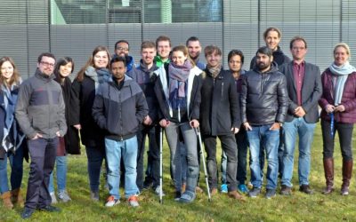
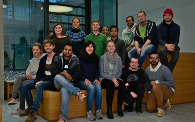
EAGLE students visit DLR-EOC
Our EAGLE 2016 students visited the DLR-EOC last Friday and got a very good overview of the work done by the scientists at DLR. Many different topics were covered and nearly all applications of applied earth observation research done at DLR-EOC were presented. ...
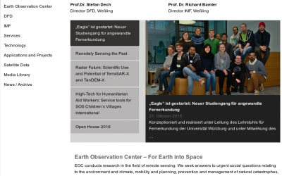
EAGLE news on DLR website
Our young EAGLEs are covered by the DLR news section! The news article covers the background of the EAGLE M.Sc. program and welcomes our new students. Great to see that our colleagues at DLR are looking forward to meet the new EAGLEs and are eager to have them as...
The 2016 EAGLEs
Our EAGLEs in 2016: Johannes Löw. Sarah Nolting, Marcus Groll, Bharath Selvaraj, Sebastian Roersch, Ahmed Saadallah, Marina Reiter, Pilar Endara Pinillos, Sazu Shahjahan, Ahmed Fowad, Jakob Schwalb-Willmann, Julia Sauerbrey, Louis Freytag, Karten Wiertz, Kamrul Islam...
Winter term about to start
The winter term is about to start. The official start of the next semester is Monday 17th. The official EAGLE welcome will be on Monday as well followed by a joint dinner before the courses start on Tuesday. Further details on course dates and locations will be posted...

applications for 2016
The application deadline for the winter term 2016 was last Friday and we are now working through the numerous application. We are happy to have received a very high number of applications from all around the world and will get back to the applicants as soon as...

application opened for winter term 2016
The application is opened to apply for the EAGLE M.Sc. program starting this winter term 2016. The application deadline is July 15th 2016 (23:59, CEST). Please feel free to contact us beforehand to discuss open questions but please check our FAQ first. EAGLE is...
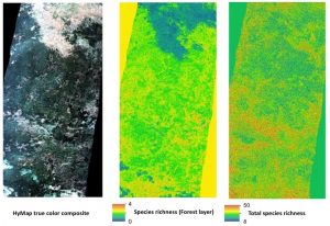
MSc opportunities: remote sensing in ecology and conservation
Biodiversity analysis and conservation decision relies on adequate and meaningful data that are available on a long-term and global basis. Such environmental information need adequate spatial and temporal resolution and remote sensing data does provide a wide range...