
Benjamin will defend his M.Sc. thesis ” DEVELOPMENT OF A SEMI-ANALYTICAL MODEL FOR SEAGRASS MAPPING USING CLOUD-BASED COMPUTING AND OPEN SOURCED OPTICAL SATELLITE DATA” on Friday March 6th 10 am in room 1.009 OKW 86.
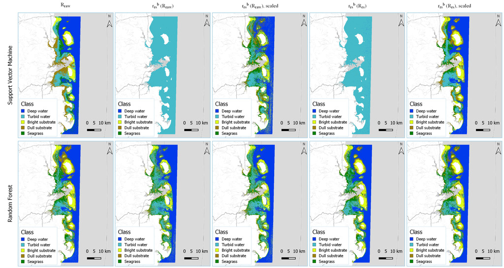
from the abstract: “Seagrasses provide USD$2.28 trillion in annual ecosystem services, with US$169 million arising solely from blue carbon sequestration, the absorption and storage of carbon emissions from these coastal vegetated ecosystems. Unfortunately, 51,000 km2 or 29% of the known global seagrasses were lost between 1879 and 2006. The best global seagrass map is an assemblage of known areas since the 1930s. With growing interests in blue carbon, a standardised approach to map seagrass is needed. Aquatic remote sensing introduces the water column as a second medium and other aquatic‑specific challenges. Solutions include the computationally expensive physics‑based or analytical approach, which is less data‑dependent than the conventional statistical approach, or the hybrid semi‑analytical approach which combines the strengths of both. Fortunately, the advent of cloud computing such as the Google Earth Engine (GEE) brings easy access to computational power. This study aims to implement a semi‑analytical approach on GEE to map seagrasses in Mozambique. A forward Hyperspectral Optimisation Process Exemplar (HOPE) model based on Sentinel‑2 was implemented and supplemented by a bathymetry log‑linear regression and published intrinsic optical properties of water (IOPs) values and/or equations. Support Vector Machine and Random Forest were used for classification. Support Vector Machine produced the best areal estimate of 3518.37 km2 with an overall accuracy of 60.27%. The best bathymetry estimate featured an R2 of 0.68. Although there was no validation for IOPs, external validation showed that the total absorption had less than 25% difference from C2RCC. While requiring further improvements, this model has shown potential for seagrass mapping, especially in remote or understudied regions, and is a step towards a global seagrass map.”




![[Spotlight] Lecturer Spotlight: Julian Faeth](https://eagle-science.org/wp-content/uploads/2026/10/Julian_Faeth_EORC_EAGLE_2026-400x250.jpg)



