
Sarah Nolting will defend her M.Sc. thesis “Risk Assessment for Flood Events based on Geo- and Socioeconomic Data – A Case Study for North-Rhine Westphalia, Germany” on Wednesday 27th 2pm in room 0.004 OKW 86.
from her abstract: “The world’s population has doubled during the last seventy years and is expected to increase further. Simultaneously extreme natural events like storms, floods or earthquakes seem to heap up. Many people lost their lives and their homes due to these severe hazardous events globally. Therefore, the protection of the population and infrastructure presents a huge challenge for policy makers. However, the assessment of human and economic loss is mostly conducted in the post-event phase. Past studies point out that risk cannot be fully characterized without taking into account the pre-event exposure and vulnerability to natural hazards. Risk assessment for flood events and other hazards would benefit from population distribution mapping of areas at risk. The largest limitation for a detailed population mapping is the data availability. Detailed population distribution mapping by the dasymetric approach needs high resolution socioeconomic and spatial data. In order to overcome this issue, this study aims to explore the possibilities of very high-resolution geodata and the combination with detailed and dynamic population data.
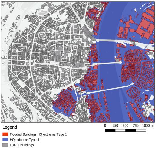
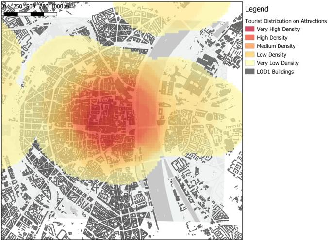
The building database “Level of Detail 1” provides information about the physical characteristics of all buildings in Germany and a usage function which classifies the predominate use of each building. Additionally, a new approach for the inclusion of TripAdvisor attractions data has been developed in order to refine the population mapping. Socioeconomic data was taken from extrapolated census data of 2016. The focus lies on the variability of population distribution on different spatiotemporal scales. The resulting population distribution and economic value map on building level was used for a quantitative and qualitative exposure assessment for three different flood scenarios in North-Rhine Westphalia in Germany. The exposure assessment shows that considering variations in population distribution leads to more accurate results than concentrating on static and undynamic population counts. The exposure assessment additionally demonstrated the importance of exposure analysis in terms of risk assessment in the pre-event phase in order to develop protection strategies for humans, buildings and critical infrastructure.”




![[Spotlight] Lecturer Spotlight: Julian Faeth](https://eagle-science.org/wp-content/uploads/2026/10/Julian_Faeth_EORC_EAGLE_2026-400x250.jpg)



