
Marina Reiter will present her M.Sc. thesis “Comparing Urban Green Spaces in German Cities Using Remote Sensing Data” on Thursday 8th of August at 11am in OKW 86, 0.004.
Looking forward to a great presentation and lively discussion afterwards. From her abstract:
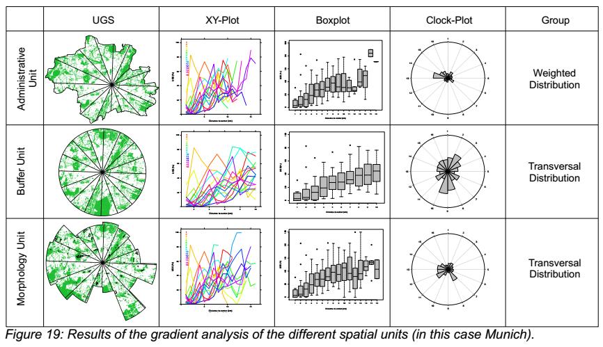
“The world is changing and so are urban areas. More and more people are moving to cities, hoping for a better future. With a rising amount of people living in cities, the improvement of urban life becomes more and more important where green spaces play a major role. For that purpose, this master thesis is intended to analyze the share and supply of urban green spaces in German cities based on the urban green proportion and the urban green provision by using Sentinel-2 satellite data. Additionally, a gradient analysis was performed to examine spatial distribution patterns of urban green spaces in German cities. By using three different spatial units (administrative boundaries, a 10-kmbuffer and algorithm-generated boundaries based on the Global Urban Footprint), this study also takes the influence of different spatial units into account. The results show that the values for each city highly depend on the chosen spatial unit. Furthermore, it was demonstrated that cities differ in their spatial distribution pattern shown by their urban green areas and that the spatial pattern is also highly influenced by the chosen spatial unit. Consequently, the choice of units for spatial analyses should be done very carefully. The results also show that administrative boundaries are suitable for spatial analyses, but the algorithm-generated boundaries have a high potential for becoming the most suitable units for spatial analyses. In the end an averaged ranking for both urban green assessment parameters, urban green proportion and urban green provision, is presented which gives a good overview of cities which have a high share or supply of urban green areas and others which should consider improvements.”




![[Spotlight] Lecturer Spotlight: Julian Faeth](https://eagle-science.org/wp-content/uploads/2026/10/Julian_Faeth_EORC_EAGLE_2026-400x250.jpg)



