
Marcus Groll handed in his M.Sc. thesis “Deep learning for Instance Segmentation of bomb craters on historical aerial images of the Second World War ” and will defend it next week.
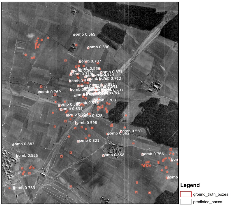
Abstract: During the Second World War (WWII) many air strikes were flown on German cities. A long time after the war, the consequences can still be recognized. About ten to fifteen percent of the dropped bombs are still lying unexploded in the ground. To find these unexploded ordnances (UXO) is nowadays an important task. Most of the UXO searching is done manually. An automatic segmentation of bomb craters on historical aerial images would help to simplify the search. So, the goal of this thesis is the creation of a deep learning instance segmentation of bomb craters from historical aerial images of WWII. The masked region based convolutional neural network (Mask R-CNN) application by ABDULLA (2017) was trained on the historical images from all over Germany. It is also possible to use this concept on every historical aerial image worldwide. The Mask R-CNN method was published in the early 2017 and until now never used for the detection of bomb craters on historical aerial images. DUTTA ET AL (2016) did the collection of the training polygons with the VGG Image Annotator. In summary 50 training and 30 validation data were used. It was decided to collect five validation images for each setting. The final Mask R-CNN model is validated via the comparison of the influences by different image settings on the model. As the image settings were chosen weather situations, bombing methods and the recorded image sizes. The TensorBoard approach and the calculation of the Average precision (AP) was applied for the validation of the model. In addition to the influence by every setting, the effects by the images themselves, hardware and software are also summarized. Finally, every setting got a big influence on the result of the model, especially the hardware and software setting. The right hardware- and software setup is a very important preprocessing step to prevent “MemoryError” messages by the system. The company Luftbilddatenbank (LBDB), in Estenfeld, close to Würzburg, Germany, provided all the historical images. This thesis was written in cooperation with them. A further target of this thesis is the creation of a plugin in a Geographic Information System (GIS) software like ArcMap or QGIS, which is able to do the instance segmentation of bomb craters. This plugin should be implemented into the workflow of the LBDB.




![[Spotlight] Lecturer Spotlight: Julian Faeth](https://eagle-science.org/wp-content/uploads/2026/10/Julian_Faeth_EORC_EAGLE_2026-400x250.jpg)



