Master Defense: Discovering Hydrographic Parameters of HydroSHEDS and TanDEM-X Digital Elevation Model through Exploratory Data Analysis” at 12:00 seminar room 3, John-Skilton-Str. 4a.

On October 29, 2024 Subarno Shankar will present his master thesis ” Discovering Hydrographic Parameters of HydroSHEDS and TanDEM-X Digital Elevation Model through Exploratory Data Analysis” at 12:00 seminar room 3, John-Skilton-Str. 4a.
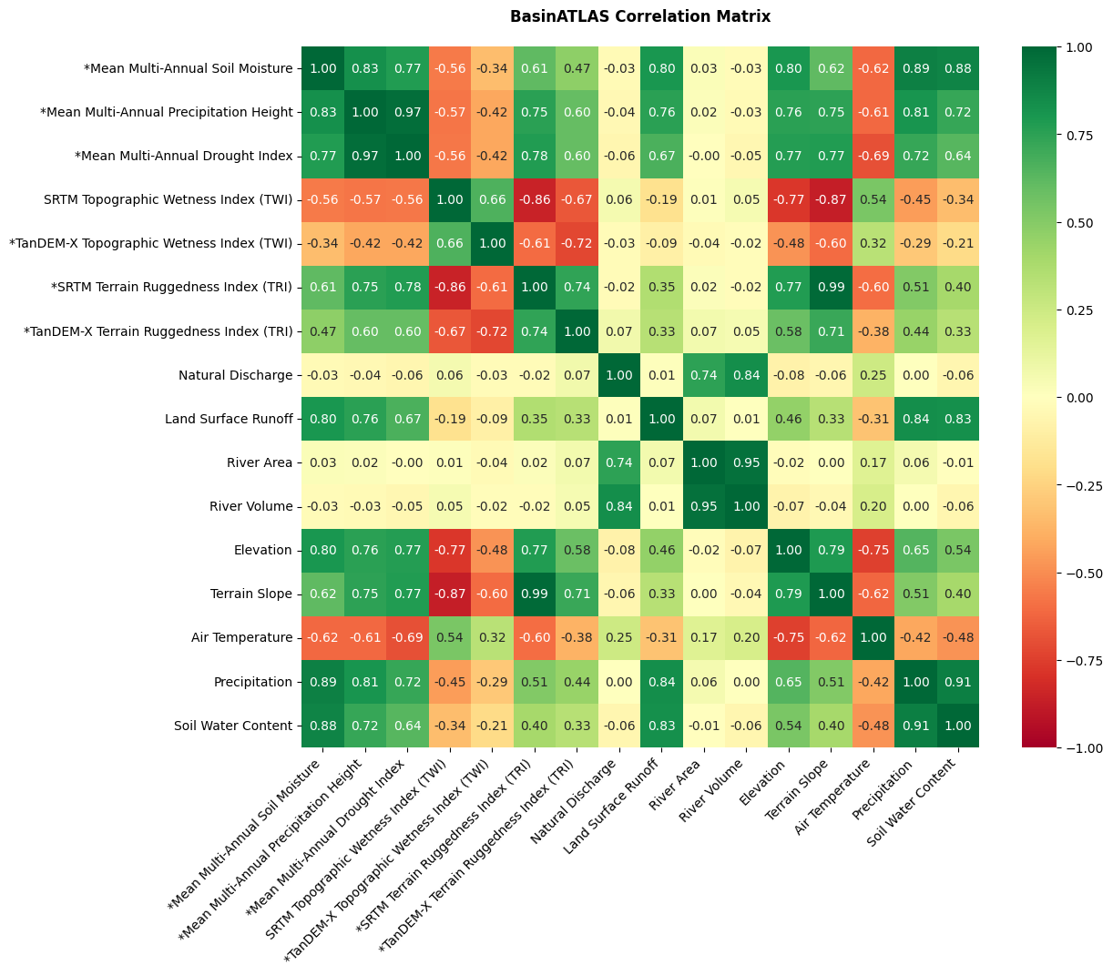
From the abstract: Climate change and anthropogenic factors, including groundwater pumping, deforestation, urbanization, and agriculture, impact the fluvial systems and cause degradation of the ecosystem. This study demonstrates the development and incorporation of geomorphometric parameters, including the Topographic Wetness Index (TWI), Terrain Ruggedness Index (TRI), and Geomorphons from the SRTM and TanDEM-X digital elevation models (DEM) into a hydro-environmental dataset termed HydroSHEDS by leveraging a hybrid workflow of QGIS and Python at a catchment scale. Additionally, the relationship of geomorphometric parameters with multi-annual environmental variables, including Soil Moisture, Precipitation Height, and Drought Index obtained from DWD and various hydro environmental features from HydroSHEDS based on environmental variables is investigated utilizing the Exploratory Data Analysis (EDA) techniques such as Descriptive Statistics, Correlation, Multiple Regression, and Clustering. The correlation analysis of environmental variables with geomorphometric parameters and hydro-environmental variables at a catchment scale indicates a moderate to strong relationship for most attributes, where SRTM exhibits a higher correlation with environmental variables than TanDEM-X. The multiple regression prediction scores for Soil Moisture (R2 = 0.94, RMSE = 0.03), Precipitation Height (R2 = 0.88, RMSE = 86.61), and Drought Index (R2= 0.86, RMSE = 6.83) indicate a strong relationship with geomorphometric parameters and BasinATLAS hydro-environmental variables. The clustering analysis using k-means clustering a silhouette score (0.52) indicates the moderate grouping of predicted catchments based on their hydrographic features. Overall, the results indicate favourable workflow compatibility for deriving and incorporating geomorphometric parameters in HydroSHEDS at a catchment scale.
1st supervisor: Prof. Dr. Tobias Ullmann 2nd supervisor: Leena Julia Warmedinger, DLR

read more news:

Welcome of new EAGLEs

Welcome of new EAGLEs

The EAGLEs from the last generation welcomed our new earth observation students to the EAGLE M.Sc. program and gave them a glimpse of their last 12 months - from coding to socialising, pub crawls to joint hikes and also a lot of best wishes from all the other EAGLEs...

Summer School of Alpine Research

Summer School of Alpine Research

Last week, Laura, an 8th gen EAGLE Student, participated in the Summer School of Alpine Research, conducted by the University of Innsbruck, in the beautiful location of the Austrian Oetztal in Obergurgl. The focus of the Summer School was on Close Range Sensing...

EAGLE M.Sc. thesis in the Arctic

EAGLE M.Sc. thesis in the Arctic

Our EAGLE student Ronja Seitz is conducting her field work for her Master thesis in the Arctic, on Svalbard. She started collecting her data in June to build up a timeseries with UAS multispectral data to investigate disturbances like rain on snow (ROS) events and...

Our EAGLE Clara is doing her internship in the Arctic

Our EAGLE Clara is doing her internship in the Arctic

Clara, an 8th gen EAGLE, is currently doing her internship in the Arctic. She spends 2 months in Longyearbyen on Svalbard where she works with colleagues from UNIS who are already collaborating with our EORC scientists, namely Dr. Bevanda. Clara works at the Arctic...

Master Defense: Comparing the suitability of remote sensing and wildlife camera time series for deriving phenological metrics of understory vegetation in temperate forests of Upper Franconia, Bavaria

Master Defense: Comparing the suitability of remote sensing and wildlife camera time series for deriving phenological metrics of understory vegetation in temperate forests of Upper Franconia, Bavaria

On September 18, Sarah Schneider will present her master thesis "Comparing the suitability of remote sensing and wildlife camera time series for deriving phenological metrics of understory vegetation in temperate forests of Upper Franconia, Bavaria" at 14:00 in...