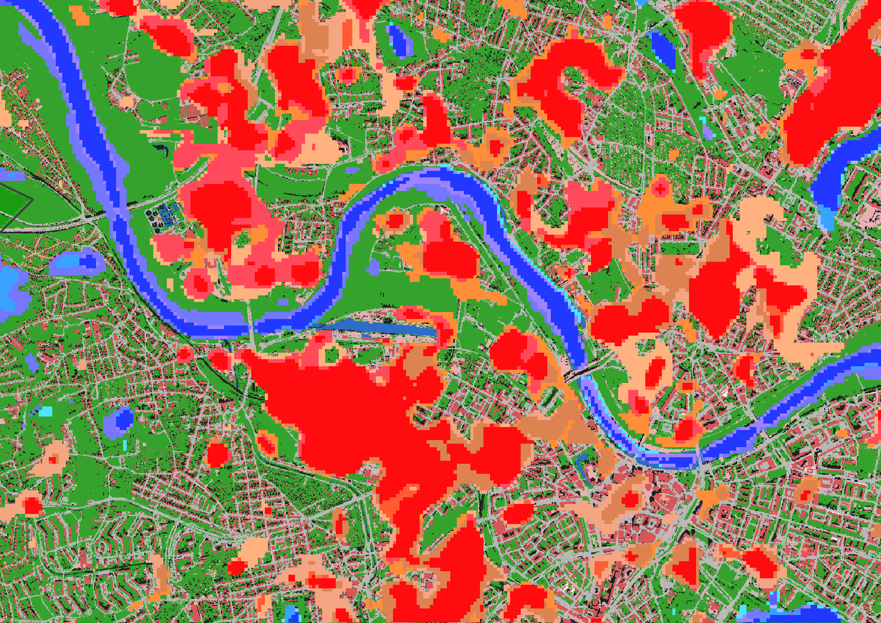
From the abstract: As the number of urban residents is projected to increase in the next decades, the well-being of a growing population is dependent on the temperatures within the world’s urban areas. The urban climate is dominated by the difference in structure of materials compared to the natural environment. The result is an increased temperature in the urban fabric compared to the rural surroundings, called the urban heat island (UHI). Due to the lack of in-situ measurements of air temperature, particularly in urban areas, this phenomenon is often studied using spatially consistent remote sensing measurements of land surface temperature (LST) from satellites such as Landsat 8. The difference in LST between rural and urban areas is called the surface urban heat island (SUHI). Understanding the SUHI itself, the intraurban differences of temperature patterns within urban areas, as well as the development of their dimensions through time are important factors for urban planning and evidence-based decision-making for sustainable and future-proof cities. In this thesis, the SUHI and the intraurban differences in heat of the urban area of Dresden, Germany were studied using satellite-based LST data acquired by Landsat 8 and 9 from 2013 to 2022. This data is aggregated into five-, three-, and two-year time-steps to overcome data gaps. The SUHI and its development through time is detected via the difference in LST in urban and rural areas . Intraurban differences are studied using spatial association: Moran’s I and G-Statistics on a global level, and on a local level Gi* hot and cold spot analysis in combination with Mann-Kendall monotonic trend test is used. Gi*-statistics are also applied to areas of LULC changes to understand their impact on the temperature of their environment. The results show an increase in SUHI intensity in Dresden during the past decade. However, it is dependent on the area with which the urban area is compared, and at which level the LST data is aggregated over time. Hot spots within the urban area in neighbourhoods of high imperviousness while cold spots area associated with areas of vegetation and water, as previously found by other authors. The analysis of LST and LULC changes does not yield easily classifiable results. The effect of drastic LULC changes is detectable using this methodology. Changes in dense urban fabric and slight changes in LULC do not show easily interpretable results.
1st supervisor: Prof. Dr. Hannes Taubenböck 2nd supervisor: Dr. Tobias Leichtle, DLR



![[presentationT] EAGLE Internship Presentation ” Research and development of data strategies for disaster management, early warning systems, and refugee data analysis”](https://eagle-science.org/wp-content/uploads/2024/12/Sources_TEMA-400x250.png)
