
M.Sc thesis (+ a two-month internship):
Agent-based modeling to understand Mediterranean wetland (former saltworks) dynamic based on multiple remote sensing data
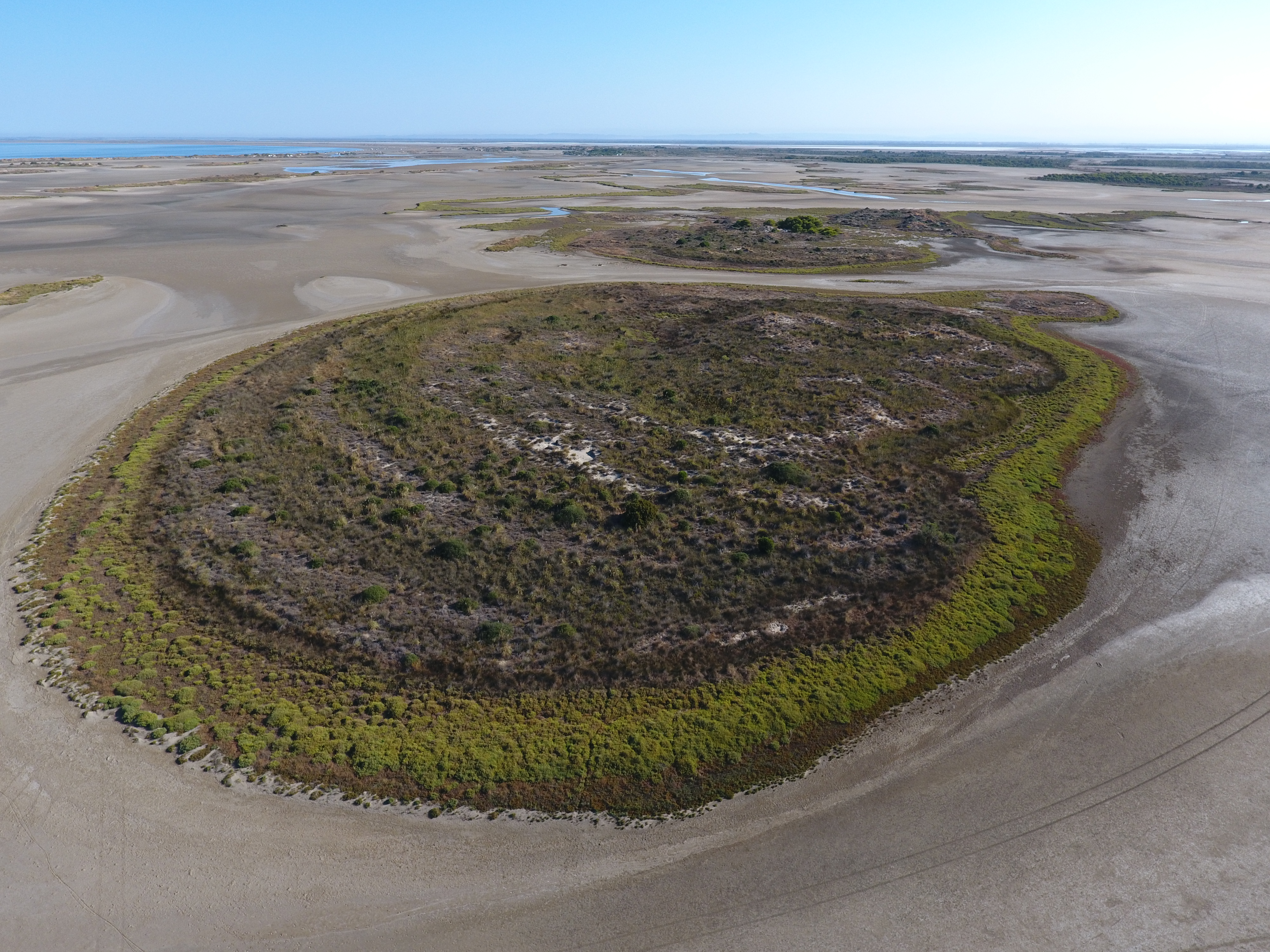
UAV imagery over a portion of the study site. Image courtesy Cyril Fleurant (Uni Angers)
The Camargue’s former saltworks is a 6500-ha site located at the Mediterranean coast in southern France. The site has been recently purchased by the Conservatoire du Littoral, a public organization created in 1975 to ensure the protection of outstanding natural areas along the coast. The ongoing management of the area has been entrusted to the natural regional parc (PNR camargue), the national reserve of Camargue and the Tour du Valat. The site comprises a wide range of habitats. It has traditionally been home to the single colony of Flamingos nesting in France and is used by thousands of shorebirds during breeding and migration. Various construction works such as embankments (to control circulation of pumped sea-water through lagoons) and sea-front dike (to prevent uncontrolled flooding by the sea) together with salt exploitation and sea-level rise led to profound changes in the landscape that in turn call for the restoration of natural processes of coastal lagoon ecosystems. However, the conservation and management measures are restricted to be timely done as a result of difficult access for ground survey. Very high resolution remote sensing can introduce alternatives to this by providing continuous and objective surface coverage.
In this context, this M.Sc project aims at developing predictive tools on the basis of remote sensing data to follow habitat dynamics in order to help adaptive ecosystem management. The objective is to develop a method to understand the fast changes of the habitats using very high resolution remote sensing data. To this aim, LiDAR and very high resolution optical data (WorldView 2) and other GIS layers will be analyzed to produce spatially-continuous input for a state-of-the-art agent-based model. Few studies have applied this modeling approach to image analysis but the first results are promising .
Agent-based modeling will allow considering multiple non parametric factors that characterize the landscape dynamics. This approach will allow taking complex spatial and temporal processes as well as changing factors into account. The GAMA agent-based simulation platform (Taillandier et al. 2014, http://gama-platform.org/) was initially developed to integrate GIS data in the simulation. Within the envisaged M.Sc work this platform will be used for prediction based on the layers created from remote sensing data.
The M.Sc thesis is planned to be ideally started with a preliminary phase of two-month internship at the LETG, University of Angers . During the internship the M.Sc student will encompass a NetLogo and GAMA learning phase and gets to know the area and data. A site visit at Tour du Valat research center may help to understand the management objective of the area. The second phase would be the M.Sc thesis, during which the candidate will spend time at both Universities of Würzburg (4 months) and Angers (2 months). The stay in Angers is supported by an existing ERASMUS agreement between the two universities.
Interested candidates are welcome to send an Email to Dr. Hooman Latifi (hooman.latifi@uni-wuerzburg.de).
Supervisors:
Dr. Aurélie Davranche (University of Angers, France)
Dr. Hooman Latifi (University of Würzburg)
Dr. Brigitte Poulin (Tour du Valat, France)




![[Spotlight] Lecturer Spotlight: Julian Faeth](https://eagle-science.org/wp-content/uploads/2026/10/Julian_Faeth_EORC_EAGLE_2026-400x250.jpg)



