
On January 21, 2025, Daria Ushakova will present her internship on “Glacier Surface Dynamics and Snowline Analysis Using Remote Sensing Data” at 13:00 in seminar room 3, John-Skilton-Str. 4a.
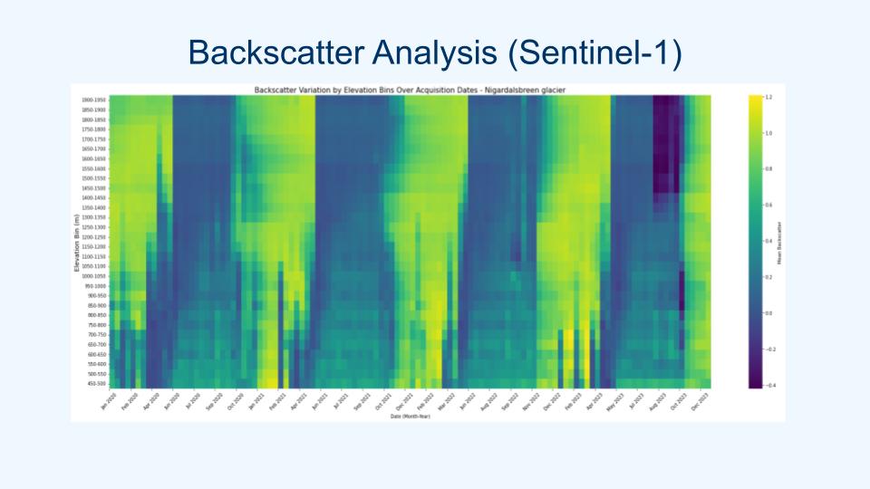
From the abstract: This internship focused on analysing glacier surface dynamics using remote sensing data to study snow and ice changes over time. The project utilized Landsat imagery, Digital Elevation Models (DEMs), and Sentinel-1A backscatter data to assess variations in Snow Line Altitude (SLA), Snow Cover Ratio (SCR), and surface roughness across multiple glaciers. Time-series data was generated to track changes in snowline and snow cover annually, and backscatter analysis was conducted to evaluate surface roughness across different elevation bins. Temperature data from nearby stations was also incorporated to provide further insights into glacier surface changes. These analyses contribute to understanding glacier dynamics and offer valuable data for monitoring glacier changes in response to climate variations.
Supervisor: Prof. Dr. Tobias Ullmann Hosting Institution: University of Bergen
From the abstract: This internship focused on analysing glacier surface dynamics using remote sensing data to study snow and ice changes over time. The project utilized Landsat imagery, Digital Elevation Models (DEMs), and Sentinel-1A backscatter data to assess variations in Snow Line Altitude (SLA), Snow Cover Ratio (SCR), and surface roughness across multiple glaciers. Time-series data was generated to track changes in snowline and snow cover annually, and backscatter analysis was conducted to evaluate surface roughness across different elevation bins. Temperature data from nearby stations was also incorporated to provide further insights into glacier surface changes. These analyses contribute to understanding glacier dynamics and offer valuable data for monitoring glacier changes in response to climate variations.
Supervisor: Prof. Dr. Tobias Ullmann Hosting Institution: University of Bergen




![[Spotlight] Lecturer Spotlight: Julian Faeth](https://eagle-science.org/wp-content/uploads/2026/10/Julian_Faeth_EORC_EAGLE_2026-400x250.jpg)



