Aim
Modern exploration for georesources is based on the spatial quantification of all those geological parameters relevant to the formation of mineral deposits. The students will obtain knowledge of the methods that can be applied to the formulation of mineral potential maps for a given region.
Content
Mineral deposits are considered products of complex mineral systems, which can be described by a number of parameters that vary in space and time. Various methods of spatially quantifying these parameters and integrating them into mineral potential maps will be discussed and applied with the help of conventional GIS software.
Coding
Coding examples and individual work will be covered
Software
Various software programs will be used, but mainly OpenSource software such as R.
Techniques
Different techniques will be introduced and practically applied.
Content
The content of scientific with regard to the audience will be discussed.
General Course News and Updates
Our newest EAGLE generation featured on 40 years of DLR Earth Observation Centre (EOC) article
We are thrilled to see our youngest EAGLE generation being mentioned on the 40 years anniversary of DLR-EOC news article. Great to see the EAGLE group on the DLR webpage (with some students missing though) fitting perfectly into the interesting and dynamic evolution...
MSc defense by Pawel Kluter
Pawel Kluter will present his M.Sc. thesis on Friday 30th of Oct. at 10 am with the title "Deep Learning Approach to Ship Detection and Classification Using Synthetic Aperture Radar Data". From his abstract: "With over 92,000 large commercial vessels at sea,...
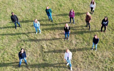
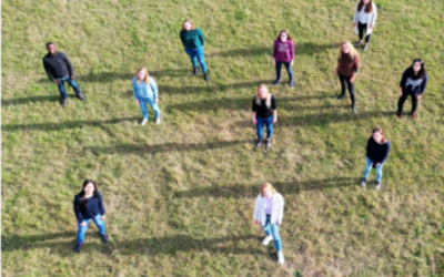
Our EAGLE 2020 generation
Our new EAGLE Earth Observation students arrived and we took a group picture while keeping the required distance due to the current situation. Unfortunately not all students could arrive on time for the group picture and hence cannot be seen on the image below. We are...
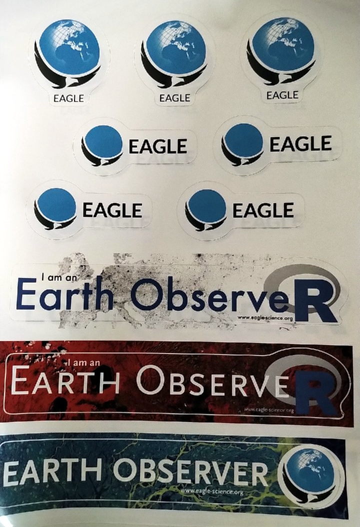
New EAGLE stickers arrived
Just in time for the welcome of the new EAGLEs we received our new EAGLE stickers. They are a first trial of irregular shaped stickers and more will come. The fit nicely with our "old" PixelschubserIn sticker (pixel pusher) and more formal "Remote Sensing Scientist"....
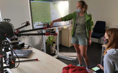
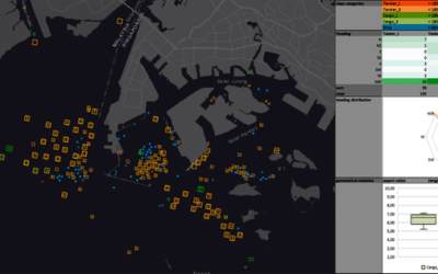
impressions of our UAV course
In September 2020 our UAV course took place and all practical exercises were covered. The manual UAV control as well as the automatic mission planning settings were discussed and actually applied. Various UAV systems were explored by the students and a diversity of...
M.Sc. presentation by Segun Adewale Ojo
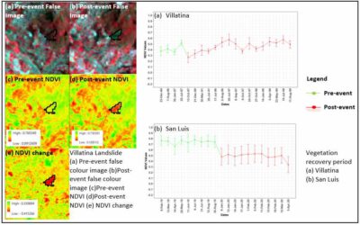
Segun will defend his M.Sc. "Application of Remote Sensing Techniques to detect historical landslides for improving risk assessment in Antioquia, Colombia." on Oct. 16th at 10 am. From the abstract: "In developing countries, current urbanization trends are leading to...
internship, inno lab and MSc idea presentations
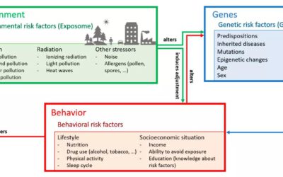
On Thursday 24th of September from 10am onwards we will have a range of presentations covering a MSc idea presentation Patrick Sogno on "Earth Observation for Exposome Mapping - Proof of Concept and Case Study in Augsburg, Germany" followed by various internship...
EAGLE student published review article with Prof. Kuenzer
Congratulations to our EAGLE student Patrick Sogno who published together with Prof. Claudia Kuenzer a review article on "Earth Observation Data Supporting Non-Communicable Disease Research: A Review". From the abstract: "A disease is non-communicable when it is not...
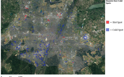
M.Sc. defense by Michael Wang
Michael Wang will present his thesis "Comparison of Surface Urban Heat Islands Using the World Settlement Footprint Imperviousness Layer" on Sept. 17th at 10am. From the abstract: "In the growing field of surface urban heat island (SUHI) analysis, impervious surface...
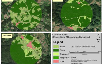
MSc. presentation by Fowad Ahmed
Fowad Ahmed will present his M.Sc. thesis "Agricultural landscape Configuration and Pattern Analysis with VHR Imagery in Bavaria" on Friday 11th at 11am. from the abstract: "Hedgerows and woody linear features are an integral part of the landscapes where they exist....