Aim
The module addresses methods on how Earth Observation and the use of geoinformation can support different fields of land and water management. The students will be guided to gain knowledge in selected practical examples.
Content
A general introduction on the subject, which strongly integrates large fields of environmental sciences and studies, is given. The students select topics in which remote sensing and geoinformation can significantly contribute parameters for answering relevant management questions. The topics include the derivation and use of parameters for monitoring land and/or water resources and examples how they can actually implemented in analytical or predictive models, or in indicator systems. The examples may include the management of the resources in rangelands, croplands, irrigation and drainage systems, river catchments, urban areas, or others. Focus may be set on special geographical settings. Depending on the selected topics and scale relevant Earth Observation parameters can include land cover and land use mapping, biophysical variables (LAI/FPAR/Chlorophyll, evapotranspiration , etc.), biomass or crop yields, soil moisture, phenological metrics and other dynamic parameters.
Coding
Software
Techniques
Content
General Course News and Updates
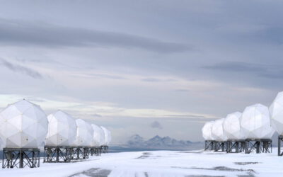
EAGLE MSc students working in the Arctic
From August to November, two EAGLE students had the opportunity to do their internship at the University Centre in Svalbard (UNIS), working in the department of Arctic Biology. Their tasks included regular drone flights in Adventdalen, a valley close to the world’s...
MSc defense by Narges Mohammadi Khoshouei
On October 06, 2023, Narges Mohammadi Khoshouei (Sanaz) successfully defended her master’s thesis entitled “Short-term forecast of water reservoir dynamics by integrating earth observation and hydrological modeling for dam management” at the Earth Observation Research...
MSc Defense by Narges Mohammadi Khoshouei
MSc Defense by Narges Mohammadi Khoshouei On Friday, October 09, 2023, at 10 a.m. Narges Mohammadi Khoshouei will present her MSc thesis "Short-term forecast of water reservoir dynamics by integrating earth observation and hydrological modeling for dam management" in...
Our EAGLE student Konstantin published an article on deep neural network regression for digital surface model generation
Our EAGLE M.Sc. student Konstantin together with our EOR cluster professor and EAGLE lecturer Hannes Taubenböck published an article about the capabilities of deep neural network regression for digital surface model generation with Sentinel-2 Imagery. Konstantin...
first EAGLE MSc. student defended his PhD
one of our very first EAGLE M.Sc. students Maninder Dhillon successfully defended his PhD! Congratulations by the whole EAGLE program and of course all EAGLE students - many of the young and older students joined his presentation and listened to his topic of...
M.Sc. defense by Luisa Pflumm on remote sensing for decision making
Luisa will defend her M.Sc. thesis "Using remote sensing to enhance conservation decision-making: The case of the little-known silver-backed chevrotain" this Friday at 10am in the meeting room John Skilton 4a. From her abstract: "Southeast Asia is a biodiverse region...
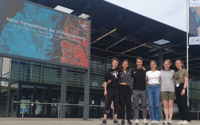
EAGLEs at DLR’s 4th Symposium “New Perspectives on Earth Observation”
From the 26th to the 28th of June, the fourth symposium on Applied Satellite Earth Observation, organized by the DLR took place in Bonn and some of the current EAGLE generation did not miss the opportunity to make a fun trip to the former capital of Germany. From...
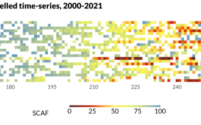
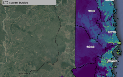
MSc defense Sub-seasonal snowline dynamics of glaciers in Central Asia from multi-sensor satellite observations, 2000-2021
MSc defense (MA2) by Dilara Kim On Monday, September 18, 2023 Dilara Kim will present her Msc Thesis at 13:00 “Sub-seasonal snowline dynamics of glaciers in Central Asia from multi-sensor satellite observations, 2000-2021” From the abstract: Glaciers are an important...
Innovation Lab Presentation by Konstantin Müller
On Tuesday, July 18 at 11 a.m. Konstantin Müller will hold his Innovation Lab Presentation "Analysis of Twitter over New Year's Eve" From the abstract: Until this day, scientists have figured out urban data and structures as morphological or topological...
Msc Defense by Katrin Wernicke
On Tuesday, July 18 at 10 a.m. Katrin Wernicke will present her MSc Thesis "Deep Learning for Refugee Camps – Mapping Settlement Extents with Sentinel-2 Imagery and Semantic Segmentation" From the abstract: The number of people forced to flee their homes has...