Aim
The module addresses methods on how Earth Observation and the use of geoinformation can support different fields of land and water management. The students will be guided to gain knowledge in selected practical examples.
Content
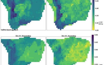
A general introduction on the subject, which strongly integrates large fields of environmental sciences and studies, is given. The students select topics in which remote sensing and geoinformation can significantly contribute parameters for answering relevant management questions. The topics include the derivation and use of parameters for monitoring land and/or water resources and examples how they can actually implemented in analytical or predictive models, or in indicator systems. The examples may include the management of the resources in rangelands, croplands, irrigation and drainage systems, river catchments, urban areas, or others. Focus may be set on special geographical settings. Depending on the selected topics and scale relevant Earth Observation parameters can include land cover and land use mapping, biophysical variables (LAI/FPAR/Chlorophyll, evapotranspiration , etc.), biomass or crop yields, soil moisture, phenological metrics and other dynamic parameters.
Coding
Software
Techniques
Content
General Course News and Updates
inno lab and MSc idea presentation
Next Tuesday, April 27th, at 10am the following EAGLE students will present their Innovation Laboratory work and their MSc thesis idea: Sandro Groth: "PortalAdminTools: A Python-based programming interface for Esri Enterprise infrastructures" (InnoLab with ESRI)Sandro...
internship and MSc idea presentation
on Tuesday April 6th 3pm we will have the folling internship and MSc idea presentations: Joy-Giovanni Matabishi, " MESMA of DESIS data to identify Rooftops in Kigali"- Internship/EKUT Luisa Pflumm, "Comparison of the performance of different accessibility layers for...
internship presentations
On Monday March 1st at 10am the following internships will be presented: Marius Witt, Baby it's cold outside - Interning at DLRs Polar Team, internship at DLR. Jakob Wachter, Potential use cases of a self established database for social media data, internship at...
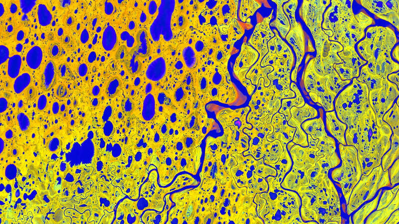
Great Earth Observation presentations despite distance learning
Despite the online courses we learned and managed to deliver great presentations on remote sensing data analysis in our courses and also improved our virtual presentation skills which might also partially be valuable in future conference or workshop presentations.
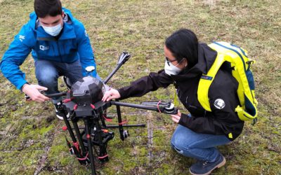
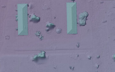
Our EAGLE students with UAV and field work jackets
Our EAGLE students preparing our UAVs with thermal, multispectral and Lidar sensors for the upcoming field work season. Also wearing our new field work jackets so that we all are easily recognizable as Earth Observation researchers.
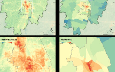
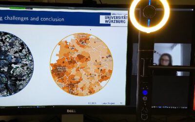
MSc thesis defense by Patrick Sogno
On Monday, 25th of January at 10 a.m., Patrick Sogno will present his M.Sc. thesis "Earth Observation for Exposome Mapping – Proof of Concept and Case Study in Augsburg, Germany". from the abstract: "Non-communicable diseases – NCDs – (asthma, cancer, or diabetes, for...
internship and inno lab presentations
On Wednesday, 27th of February at 2pm we will have the first set of internship and innovation laboratory presentations in 2021: Yan Chak Christopher Chan: Start-up life and Deep Learning (Internship) Nils Karges: Noise and its relation to urban structural types...
internship, inno lab and MSc idea
On Monday 21st of December at 10am we will have the following presentations: Camilo (Internship)"Forest cover change between 2000 and 2020 in El Chaco ecoregion, Paraguay" at DLR Johannes Mast (Thesis Idea):"Measuring Urban Polycentricity using Remote Sensing"...
EAGLE wall of graduates is growing steadily
Our EAGLE wall of fame is being continuously extended by pictures of our new graduates and the group pictures of our EAGLE cohortes. Great to see their pictures on our wall and following their career past the EAGLE M.Sc.. Very interesting positions from companies to...
MSc defense by Aiga Taghavi
Aida Taghavi will present her M.Sc. thesis "Potentials of Cosmic-Ray Neutron Probes for Assessing and Mapping SAR-based Soil Moisture in a Mediterranean agro-forestry ecosystem" on Dec. 15th at 1pm. From her abstract: "Accurate near-surface soil moisture (~ 5cm,...