Aim
In this lecture you will gain a broad overview of the applications of remote sensing. Examples from different disciplines and applied Earth Observation projects will provide your with a comprehensive understanding of if, where and how remote sensing can contribute to qualitative and quantitative assessments of the cryosphere, forest ecosystems, agro-ecosystems, the coastal zone and urban ecosystems; amongst others. We will evaluate the potential of passive and active sensor systems and adress the advantages and shortcomings of existing sensors in the optical / mutlsispectral, thermal and microwave domain.
Content
This lecture provides knowledge on applications of Earth Observation with a focus on remote sensing of the land surface. Which research questions of different disciplines can be answered by the means of Earth Observation? What are the main approaches? The module links up remote sensing measurements to geo- and biophysical parameters required for further geoanalysis. Commonly used methodological approaches for the derivation of the different parameters are presented. Examples include amongst others applications in geography, environmental planning, ecology, biology, oceanology, soil science, geology, atmospheric science, but also e.g. pollution control (monitoring) and natural resource management. In addition, the module outlines selected examples, how remote sensing technology can be transferred to the workplace of professionals also beyond science, e.g. via the use of geoinformation systems.
General Course News and Updates
Maninder Singh Dhillon handed in his MSc
Maninder Singh Dhillon handed in his M.Sc. "Comparing the performance of crop growth models using synthetic remote sensing data at DEMMIN, Germany" supervised by Thorsten Dahms with the first and second supervisors Martin Wegmann and Christopher Conrad, respectively....

EAGLE visit DLR-EOC
Our EAGLEs in 2018 visited the German Aerospace Center, namely the Earth Observation Center, close to Munich. Various topics were presented by DLR scientist and the EAGLEs hat the chance to discuss various topics in small groups with individual scientists.
Internship and M.Sc. idea presentations
on Thursday, December 13th, at 12:30 we will have the following presentations in the student working room (Josef Martin Weg 52, 3rd floor): internship presentations: Johni Miah"Remote Sensing and Geographic Information System for Decision...
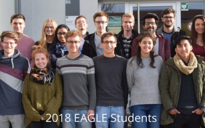
New 2018 EAGLE students now online
Web presence of you new EAGLE students is online. Our new 2018 EAGLE students created their own webspace in order to present the group and each student individually. Have a look who started EAGLE this year, read about their background and interests - and especially...
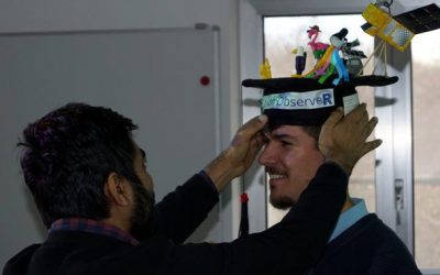
M.Sc. graduation by Jakob Schwalb-Willmann
Congratulation to Jakob Schwalb-Willmann who successfully graduated today! His M.Sc. topic was "A deep learning movement prediction framework for identifying anomalies in animal-environment interactions" aiming to explore the potential of animal movement...

EAGLE welcome 2018
Our new EAGLEs arrived! We welcomed our new international EAGLE students from the US, Ecuador, Bangladesh, Ruanda or Germany for the upcoming winter term and introduced the lectures as well as the courses. In the evening we had a joint dinner to get to...

EAGLE M.Sc. idea presentations
On Monday, 24th of September from 1:30 onwards the following EAGLE students will present their M.Sc. idea. Everybody is welcome to join their presentations and to provide feedback: Julia: "Time-Series Analysis of Sentinel-1 and Sentinel-2...

EAGLE Internships
On Monday, 24th of September, at 1pm the following internship reports will be presented: Bharath: "Installation and Characterization of an imaging Spectrometer for the UAV-based remote sensing" Johannes: "Crop classification based on S1/S2 in...
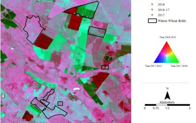
New MSc thesis: Time series analysis in Colombian Orinoco Basin
Pilar Endara started her M.Sc. thesis on "Time series analysis of flooding and vegetation patterns in wetlands of the Colombian Orinoco Basin" The ecosystems that are present within Colombian Orinoquia flooded savannas are currently being threatened by conversion of...
Internship, Innovation Lab and MSc idea presentations
The following students presented their innovation labs, internships and ideas for MSc. thesis: Ahmed: Innovation Lab at DLR (team of Ursula Gessner) and Master Thesis Idea: Title: Status of Agricultural Lands in Egypt using Earth Observation Maninder (at DLR,...