Aim
This course provides detailed knowledge of programming or coding using spatial data, especially for remote sensing and GIS tasks.
Content
Different spatial programming approaches are covered using actual remote sensing and GIS data to enable the students to apply a variety of methods in a semi-automatic manner for remote sensing data analysis. All methods will be practically applied during the course using the programming language R and maybe other programs such as GRASS, SAGA, QGIS or OTB. This course continues where the “Programming and Geostatistics” courses stopped and is considered a prerequisite. Both courses are tightly linked
Coding
Software
Techniques
Content
General Course News and Updates
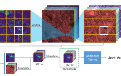
Deep Neural Network Regression for Normalized Digital Surface Model Generation with Sentinel-2 Imagery
Our EAGLE student Konstantin Müller published together with our chairholder of the Deparment of Global Urbanization and Remote Sensing, Hannes Taubenboeck an article about DL for surface model generation. The article explores methods to extract high-resolution...
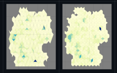
new QGIS plugin and R package
our EAGLE student Konstantin Müller created a QGIS plugin and a corresponding R package for easy point density vizualisation. Create way to learn how to build QGIS plugins and R package for spatial analysis. QGIS plugin: The Bestagon QGIS plugin allows easy density...
MSc defense by Joy Giovanni Matabishi
On Tuesday, October 31, 2023 at 12 a.m Joy-Giovanni Matabishi will present his Msc Thesis “Modelling Bat Distribution and Diversity with Artificial light as a Focal Predictor in South Tyrol” in the seminar room 3 in John-Skilton-Str. 4a/ground floor. Modelling Bat...
MSc defense by Vanessa Rittlinger
On Tuesday, October 24, 2023 at 12:00 a.m. Vanessa Rittllinger will present her master thesis on “Detection of landslides in space and time using optical remote sensing data – A case study in South Tyrol” in seminar room 3 in John-Skilton-Str. 4a/ground floor From the...
MSc defense by Moritz Rösch
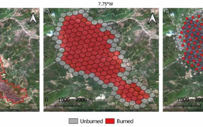
On Tuesday, November 27 at 12:00 a.m., 2023 Moritz Rösch will present his MSc defense “Daily spread prediction of European wildfires based on historical burned area time series from Earth observation data using spatio-temporal graph neural networks” in the seminar...
Internship Report
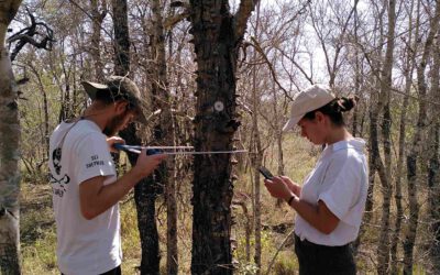
On Tuesday, December 12, 2023 at 12:00 a.m. Sunniva McKeever, Maximilian Merzdorf, and Isabella Metz will present their internship report on their internship at the Kruger National Park, South Africa in seminar room 3 in John-Skilton-Str. 4a/ground floor Subject: "Our...
Internship Report by Christobal Tobbin
On Tuesday, November 28, 2023 at 13:00 Christobal Tobbin will present his internship report on his internship at DLR “The CONCERT Project” in seminar room 3 in John-Skilton-Str. 4a/ground floor. From the abstract: The CONCERT project with the Agriculture and...
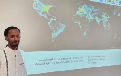
Successful MSc defense by Giovanni Matabishi
Giovanni presented his MSc thesis “Modelling Bat Distribution and Diversity with Artificial light as a Focal Predictor in South Tyrol” today within our EAGLE colloquium and passed successfully. He presented very interesting approaches of remote sensing for modelling...
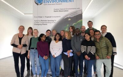
EAGLE 8th generation – first course by Claudia Kuenzer
Our new EAGLEs just spend the whole week learning about all Earth Observation sensors, physics of remote sensing, newest advances and upcoming methods in earth observation. Beside the lecture and getting to know all these crucial information they also had plenty of...
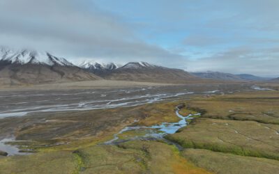
Internship Report by Janik Hoffmann and Lena Jäger
On Tuesday, December 19, 2023 at 12:00 Janik Hoffmann and Lena Jäger will present their internship report on their internship at the University Centre on Svalbard/Norway "Our Arctic Adventure – Northernmost internship on Svalbard" in seminar room 3 in...