Aim
This course provides detailed knowledge of programming or coding using spatial data, especially for remote sensing and GIS tasks.
Content
Different spatial programming approaches are covered using actual remote sensing and GIS data to enable the students to apply a variety of methods in a semi-automatic manner for remote sensing data analysis. All methods will be practically applied during the course using the programming language R and maybe other programs such as GRASS, SAGA, QGIS or OTB. This course continues where the “Programming and Geostatistics” courses stopped and is considered a prerequisite. Both courses are tightly linked
Coding
Software
Techniques
Content
General Course News and Updates
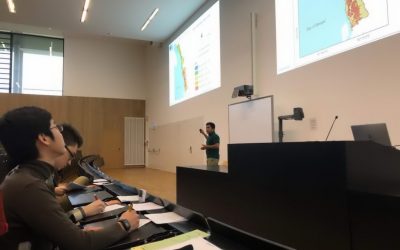
Scientific Presentation of Earth Observation Applications
As every term our students could participated in a scientific presentation course where they learned how to prepare, design and defend a scientific talk. Beside the theoretical part many practical exercises were part of this course and a final presentation in a large...
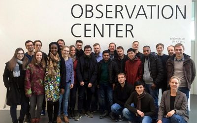
EAGLE excursion to DLR-EOC
Our 2017 EAGLEs spend a great day at DLR-EOC close to Munich and learnt a lot about applied remote sensing. Beside talks about a variety of topics did the EAGLE students also have the chance to discuss in small groups with DLR scientists their research or...
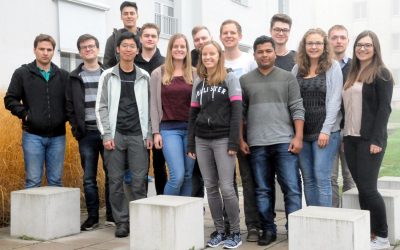
EAGLE 2017 students
Our new EAGLEs arrived and started their M.Sc. on Applied Earth Observation. During the official welcome all new students were introduced to the lecturer and the EAGLE students board. A joint dinner allowed to get to know everybody and address a...

Winter term 2017 is about to start
While the "old" EAGLEs are spending their 3rd term doing internships or innovation laboratories in Italy, Portugal, Poland or Burkina Faso at various research organizations or companies, the new EAGLEs for the winter term 2017/2018 will be welcomed next week. The...
Remote Sensing in Ecology
The EAGLE course "Remote Sensing in Biodiversity and Conservation Science" took place in the last week of the summer term at the field research station in Fabrik Schleichach, Steigerwald. 20 biology and EAGLE students worked and lived together for one week and...
final course presentations
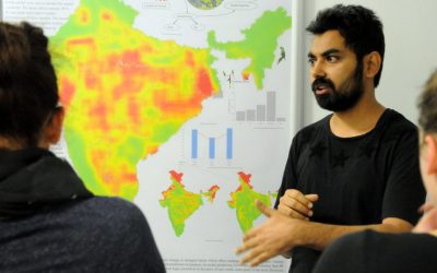
Our EAGLE students had to present their work as posters, reports or oral presentations at the end of the summer term and could show impressive achievements and results of small research projects.Some impressions of their oral and poster presentations can...
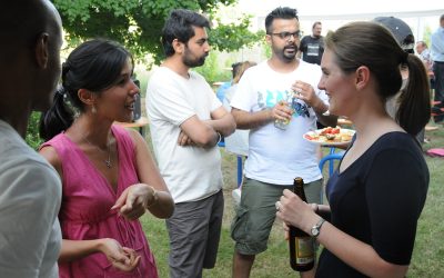
First EAGLE Midsummer Dialogue
Beside participants from the University of Wuerzburg and the DLR, also many colleagues from companies and a variety of national and international research institutions joined this event. The midsummer dialogue was organized by the EAGLE students. The students were...
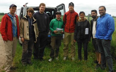
First EAGLE field methods course successfully accomplished
The first field methods course in our EAGLE MSc programme took place in the JECAM test site of DEMMIN-Germany (close to the city of Demmin in Mecklenburg-Vorpommerania) from 12.- 17.6.2017. Six EAGLE students, one colleagues of DLR, Dr. Erik Borg, and two lecturers,...
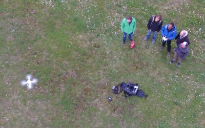
UAV application for remote sensing course started
The course on UAV application for Remote Sensing started successfully. The weather was good enough to do some first flights. In the next weeks and months more flights will be undertaken and data collected for different fields sites in order to gain more information...
application deadline in 7 days
The application deadline for the upcoming winter term is approaching. Apply within the next 7 days here: http://eagle-science.org/apply - application deadline is May 15th, further details about needed documents are listed on the application page. Learn within EAGLE...