Aim
Within this course we aim to discuss and develop a knowledge platform, using existing remote sensing tools and products, to enable conservation impact in cooperation with experts from WWF Germany.
Content
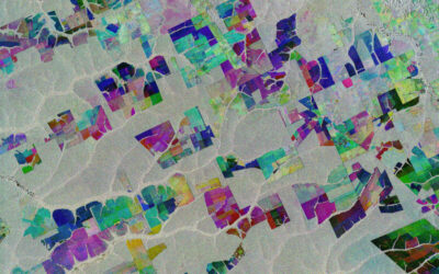
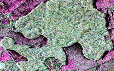
In this seminar we want to tackle the questions how remote sensing-derived products can support conservation and sustainable, equitable development and help NGOs to better monitor, understand and evaluate the effectiveness of their work. As WWF Germany we want to stop the worldwide destruction of nature and the environment and shape a future, in which humans and nature live in harmony with each other. Spatial biodiversity and environmental data availability are growing rapidly and provide a remarkable opportunity for NGOs. However, direct use of EO based information is currently still limited. Expert knowledge is needed to find, evaluate, and correctly apply the RS products. Experts from our practices will join the seminar outlining their current needs, concerns and challenges. Using their requirements, we will review existing remote sensing products, services and research methodologies and discuss potential applications, pitfalls, and limitations. Each team of students will work on one thematic to pic. The output of this seminar will be an interactive short info sheets prepared by each team for non-experts publicly available on https://space-science.wwf.de as an ESRI ArcGIS online story map and map apps with suitable data via GLOBIL.
Coding
Coding examples and individual work will be covered
Software
Various software programs will be used, but mainly OpenSource software such as R.
Techniques
Different techniques will be introduced and practically applied.
Content
The content of scientific with regard to the audience will be discussed.
General Course News and Updates
MSc idea & internship
On Monday, Dec. 7th at 10am, various internships, innovation labs and M.Sc. ideas will be presented: Malin Fischer: EO and spatial data analysis for rural village assessment - example from the electrification sector (Internship) Henrik Fisser: Road traffic...
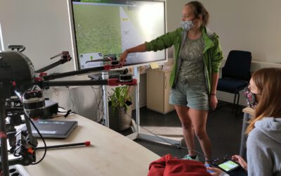
impressions of our UAV course
In September 2020 our UAV course took place and all practical exercises were covered. The manual UAV control as well as the automatic mission planning settings were discussed and actually applied. Various UAV systems were explored by the students and a diversity of...
Internship presentations
On Thursday 30th at 10 am the following EAGLE students will present their internships or inno labs: Tobias Gutzmann: 'Aerial Image Analysis for WW2 Warfare Material Detection' at Luftbilddatenbank Henrik Fisser: 'Sentinel-2 Truck Detection - Sensing Trade from Space...
2020 applications
We received again a high number of very good applicants and are currently working through all application files. We will invite all eligible applicants in the next weeks for an interview. In total we received 137 eligible applications from the EU as well as North and...
internship presentation by Henrik Fisser and Ronja Lappe
On Friday 24th of January at 10 am in room 1.009 OKW 86 the following two internship presentation will take place: Henrik Fisser: "Into the Uncertain - Noise Quantification of Sentinel-2 Water Signal in Dependence of Atmospheric Correction Methods"and some details...

Internship and MSc idea presentations
On Friday 10th of January the following presentations will take place in OKW86, room 1.009 from 10am onwards. Ojo Segun Adewale:Internship: Prediction of Gross Domestic Product using Remote Sensing Data (A case study of Brazil). Thesis Idea: Application of Remote...
M.Sc. Idea presentation by Nina Gnann and internship by Basil Tufail and Malin Fischer
Nina, Malin and Basil will present their M.Sc. idea and internships on Friday 20th of December in room 1.009 OKW 86. Ninas' envisioned M.Sc. is "Plastic waste detection assisted by artificial intelligence". Basil internship is titled: "Global training dataset for...
MSc idea and internship presentations
On Friday, 8th of November, from 10-12am the following presentation will take place in room 01.009, OKW 86: Michael Wang:"Deriving Surface Heat Island Intensities for TraK and CURE" - internship and thesis idea presentation Patrick Sogno:"The Hitchhikers Guide to an...
M.Sc. idea presentations and internship presentation
On Friday 25th of October several EAGLEs will present their M.Sc. thesis ideas and report back from an internship experience. It will take place at 10am in room 1.009, OKW 86. Katrin Hasenbein (MSc idea): "The potential of time-series data to improve fine scale...
Internship and InnoLab presentations
On Monday, 14th of October, at 5pm in room ZHSG 01.002, after the welcome of the new EAGLEs we will have the following internship and Innovation Laboratory presentations: Pawel Kluter (Internship): "Remote Sensing in the Federal Criminal Police Office" Pawel Kluter...