Lecturer
Julia Rieder
ECTS
5 ECTS
Aim
The course provides a practical introduction to LiDAR technology and point cloud analysis. Students gain hands-on experience with LiDAR data, from acquisition principles to processing and interpretation, and learn how LiDAR supports applications such as terrain modelling, forestry, and others. The course emphasizes critical understanding of data quality, limitations, and real-world use cases
Content
This course provides an overview of the scientific field surrounding LiDAR as a key technology for three-dimensional Earth observation. The course covers the fundamentals of LiDAR remote sensing, point cloud data structures, and processing methodologies across platforms ranging from spaceborne and airborne systems to terrestrial and mobile laser scanning. Furthermore, the course highlights current developments and emerging analytical possibilities enabled by advanced point cloud analysis and discusses future potential as LiDAR technologies and methodologies continue to evolve and converge with related disciplines.
Coding
Software
Techniques
Content
General Course News and Updates

Across Cohorts and Borders: EAGLE Students Celebrate the Winter Term Together
As the winter term ends, the international students of our EAGLE M.Sc. programme gathered for an evening that was less about deadlines and data and more about community. After months of intensive coursework and research, the celebration offered a warm pause in their...
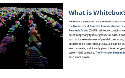
Learning Geospatial Tools in Practice: whitebox
A central goal of the EAGLE Earth Observation programme is to equip students with a broad and practical understanding of the software tools used in geospatial analysis. Rather than focusing on a single platform, students are encouraged to explore different approaches,...
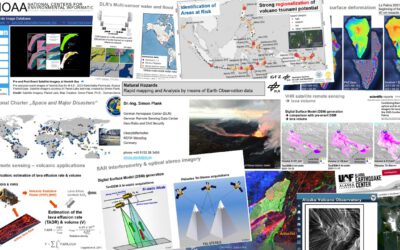
Mapping Disasters from Space: Inside the EAGLE MSc Course on Natural Hazards
From raging wildfires to devastating floods, natural hazards are becoming more frequent, more intense, and harder to predict. In this rapidly changing world, the ability to understand disasters as they unfold is no longer optional—it’s essential. This is exactly where...
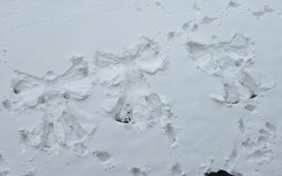
From Satellites to Snow Angels
Our EAGLE M.Sc. students, coming from all over the world, are making the most of the short breaks between courses. Whether it’s spontaneous snow angel sessions or friendly snowball fights around the EORC, laughter and flying snow are never far away. These moments of...
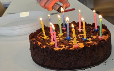
Where Learning Meets Friendship
At EAGLE, studying together is only part of the story. Our students are more than classmates — they’re hiking buddies, party companions, and the kind of people who show up to lectures with birthday cakes 🎂. Today was a perfect example. Our EAGLE student...
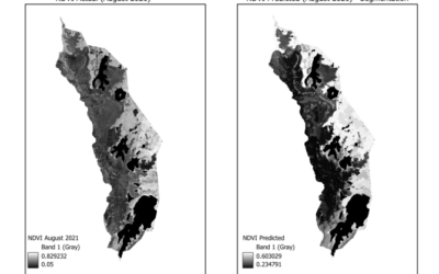
EAGLE Innolab Presentation: “Gap-Filling Optical NDVI Using SAR-Derived Indices and Machine Learning”
On February 10, 2026, Mahnoor Nadeem will present her Innolab results on " Gap-Filling Optical NDVI Using SAR-Derived Indices and Machine Learning" at 12:00 in seminar room 3, John-Skilton-Str. 4a. From the abstract: Normalized Difference Vegetation Index (NDVI) is...
EAGLE Internship Presentation: “Internship at Helmholtz Zentrum Munich”
On February 03, 2026, Agnes Zwick will present her internship "Internship at Helmholtz Zentrum Munich" at 12:00 in seminar room 3, John-Skilton-Str. 4a. From the abstract: From September to October 2025, the internship was completed at the Helmholtz Zentrum München...
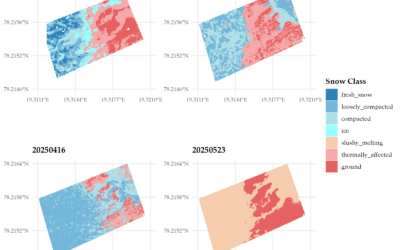
EAGLE MSc Defense: “Assessing the potential of thermal UAS for spatio-temporal Arctic snow monitoring – A pilot study in Bjørndalen, Svalbard”
On February 24, 2026, Lena Jäger will present her Master Thesis on "Assessing the potential of thermal UAS for spatio-temporal Arctic snow monitoring - A pilot study in Bjørndalen, Svalbard" at 12:00 in seminar room 3, John-Skilton-Str. 4a. From the abstract: The...
Learning Earth Observation Data Acquisition in Real-World Conditions
As part of our course on Earth Observation data acquisition, EAGLE students experience first-hand that even the best planning is ultimately shaped by the weather. While flight plans, measurement strategies, and schedules can be carefully prepared in advance, field...
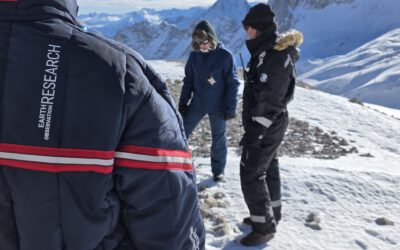
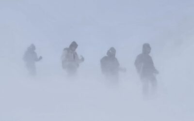
Snow Research at Schneefernerhaus, Zugspitze
Recently, our team carried out another successful field campaign at the Schneefernerhaus research station on the Zugspitze in the Alps. Together with our EAGLE students, we collected UAS-based environmental data alongside detailed in-situ measurements of snow...